Tag: adventure

  • Return to Donner Tunnels: 6 miles and lots of street art

    Photo from the Donner Pass railroad tunnels

    Friday’s seem to be my peak boredom day for some reason – once again, I wanted to get out of the house. I was considering heading back to the Donner Tunnels to complete the full hike next week, but it was supposed to be a beautiful day, so Donner Pass beckoned once again.

    Other than completing the full six mile round-trip hike, my goal was to focus on photographing the street art. And whatever else seemed interesting. I had lured a friend interested in photography to come along, so off we went in the morning, with camera gear and lots of flashlights (some with new batteries this time). I did forget one important thing – the 250G SD card for my Sony A7. Fortunately, the camera has two cards, and the second was still in the camera. Near disaster for sure.

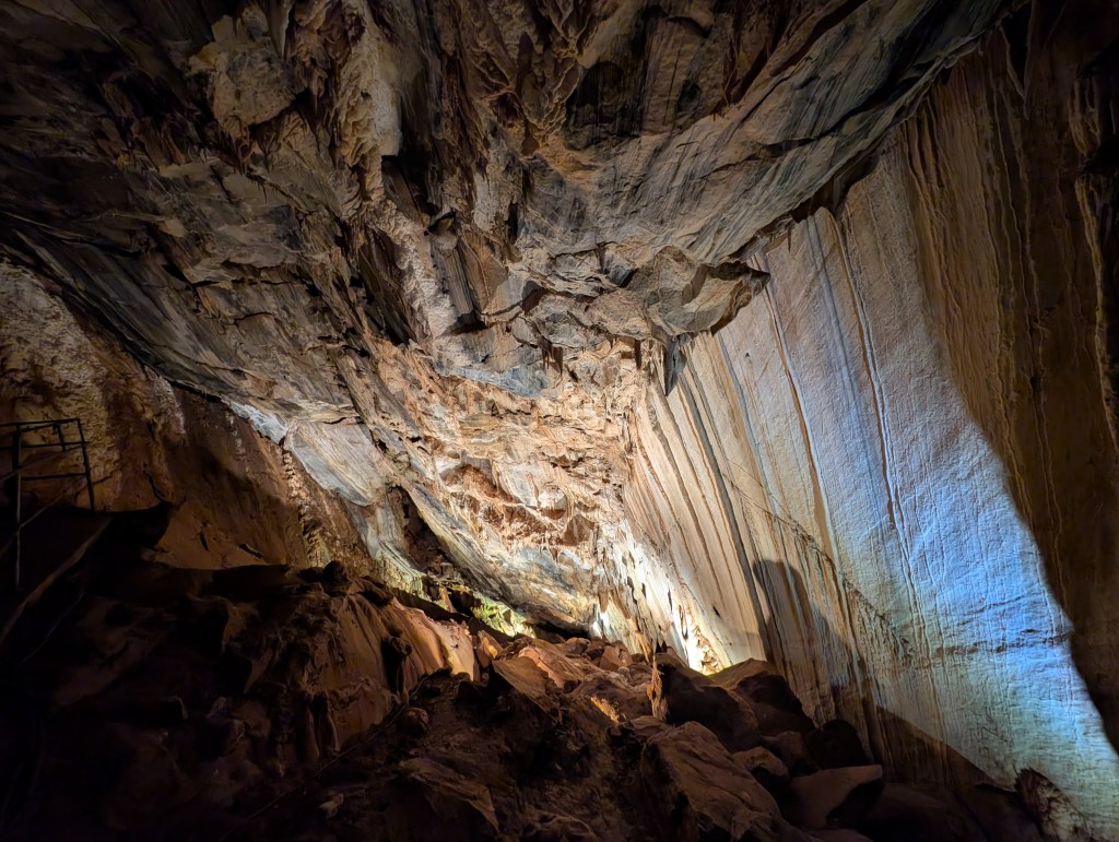
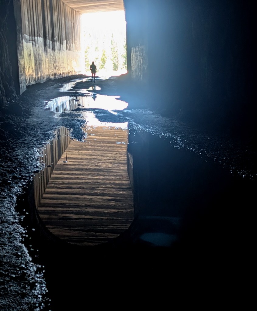
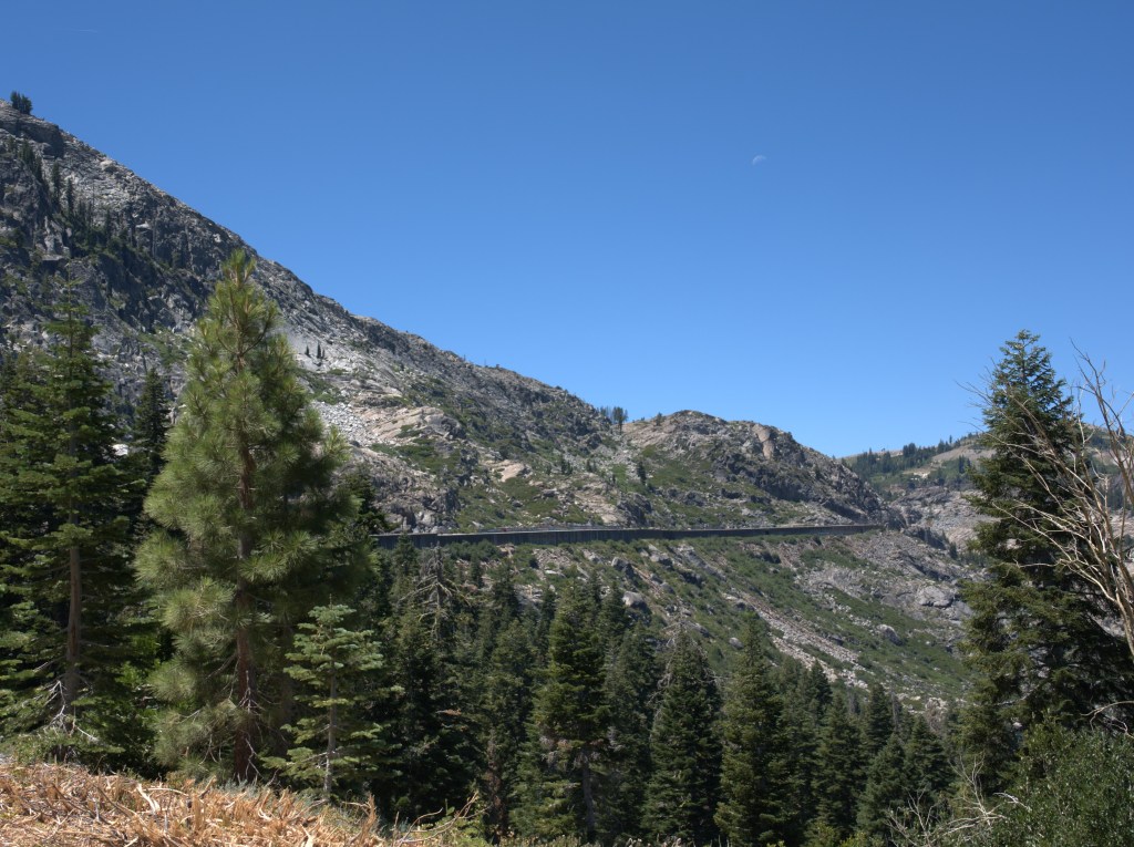
    The Donner Tunnels are not just the rock tunnels blasted out by the Chinese immigrants hired to build this segment of the Transcontinental Railroad, the trail also includes long segments of very large, concrete snow sheds. Many of these connect directly to the rock tunnels. So when you are hiking this trail, you spend a great deal of time either in very dark, cave-like rock tunnels, or in the dimly lit snow sheds. Flashlites are a must since the trail is covered with large gravel, with occasional larger chunks of rock scattered about. I would not recommend falling on this trail.

    On my first hike, I covered tunnels 6-8, which included the long, dark tunnel at the head of the trail, and one very long snow shed. The remainder of the trail covers tunnels 9-11, which includes another long section of snow shed, and 2 moderate sized rock tunnels attached to snow sheds. All told, it’s about 3 miles from the parking lot to the end of the last tunnel. Nice, easy walking on rough gravel, with pools of water, and dimly lit trip rocks.

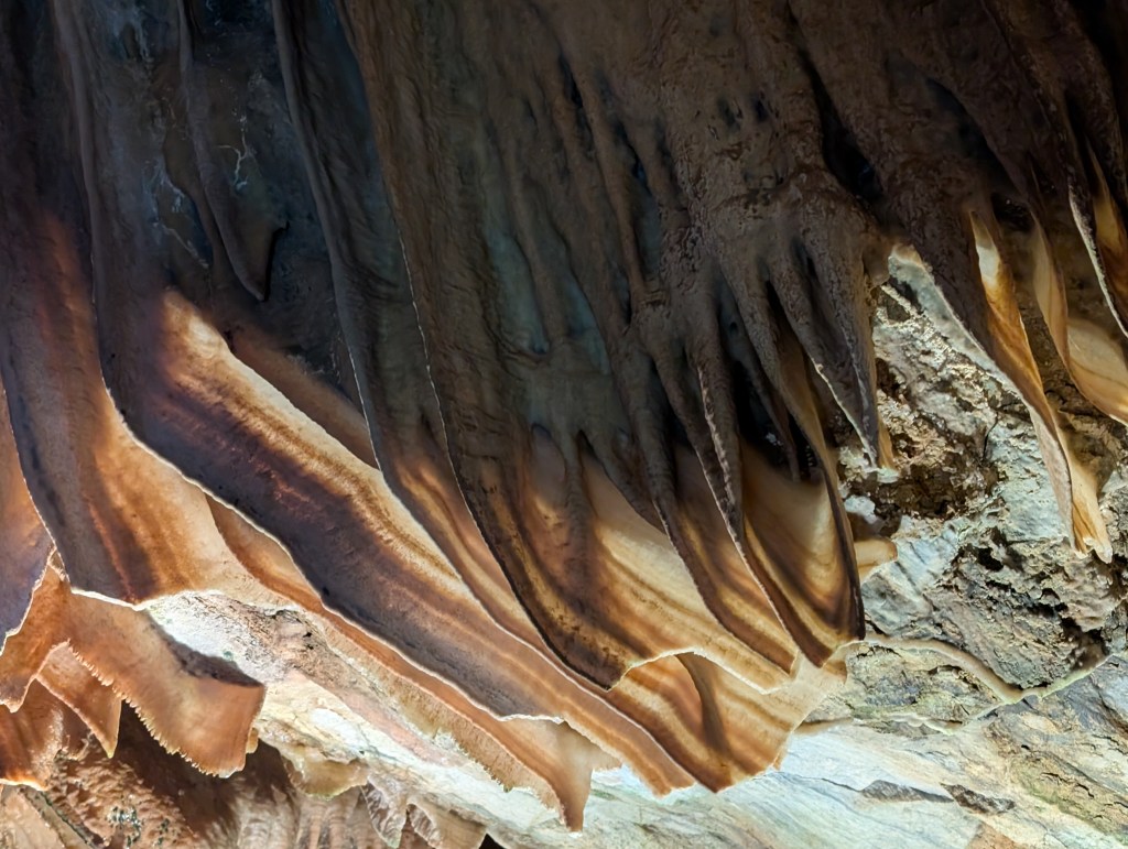
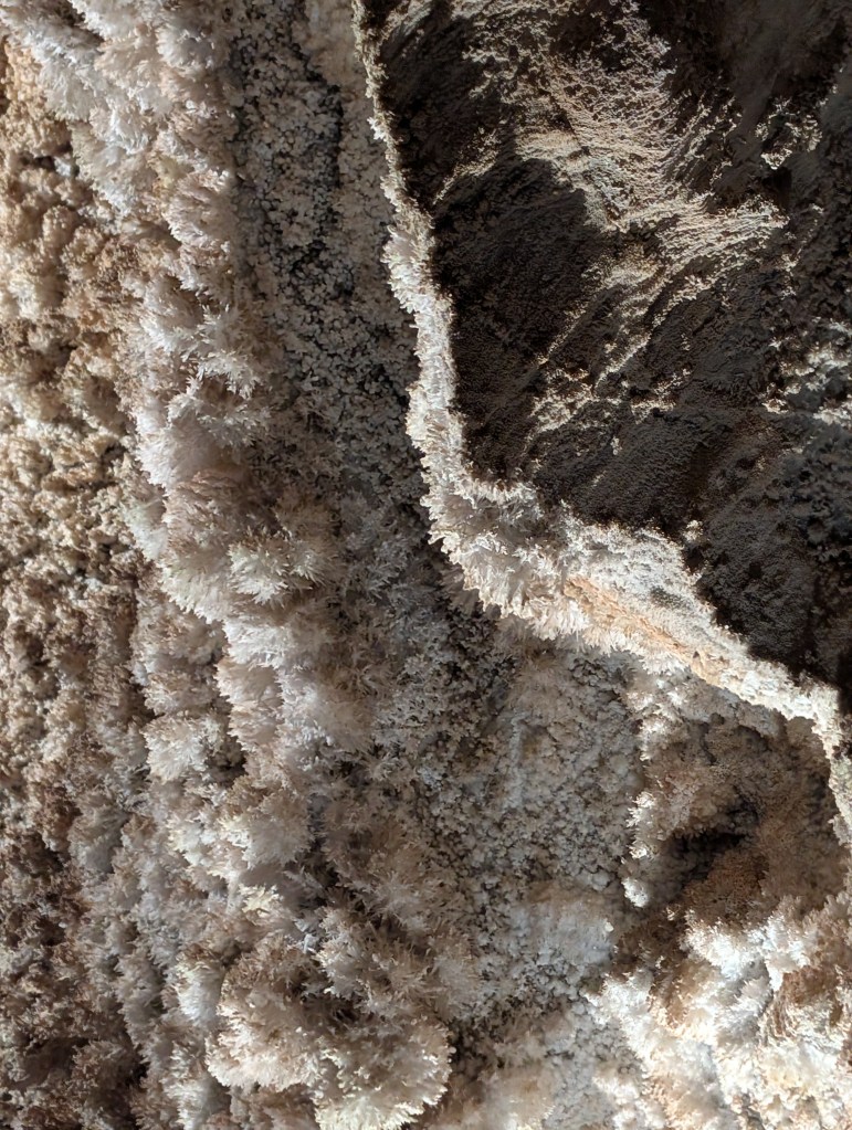
    Since this was a photo-hike, I’ll dispense with my usual endless chatter, and just show a bunch of photos (with captions), starting with some of the exterior photos.

    Tunnel Photo’s

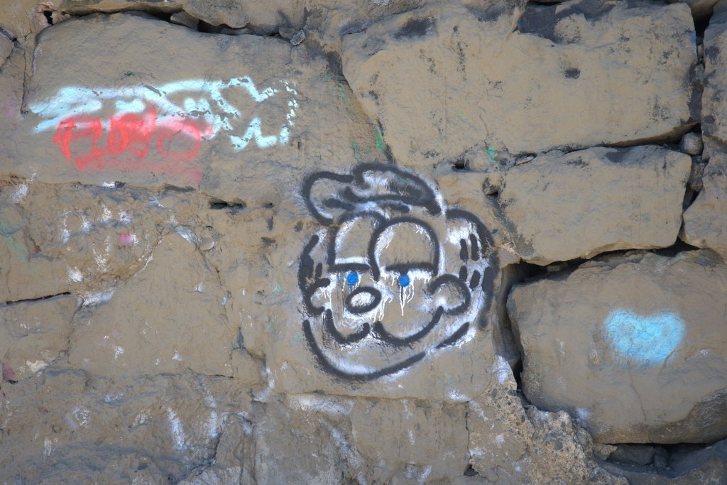
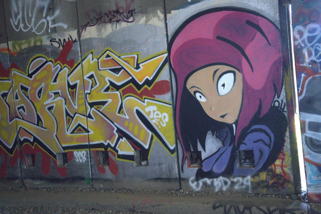
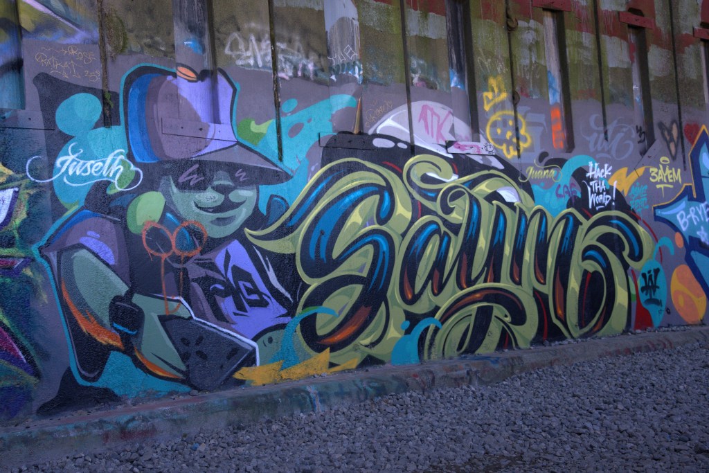
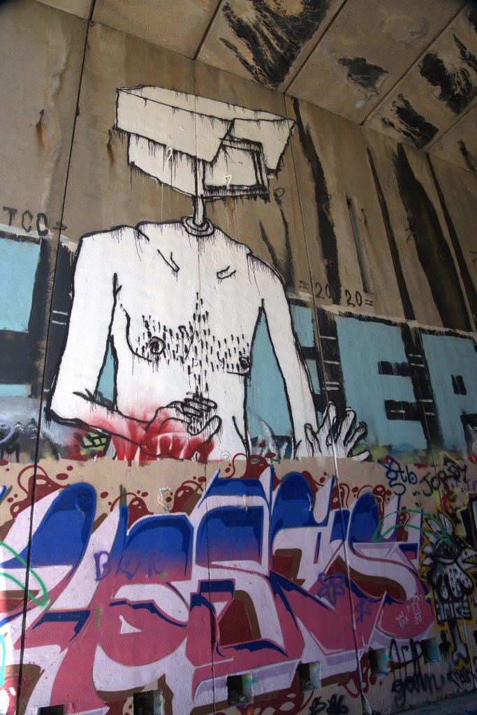
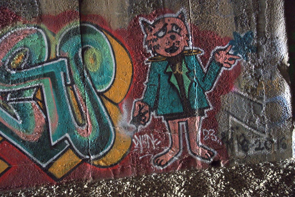
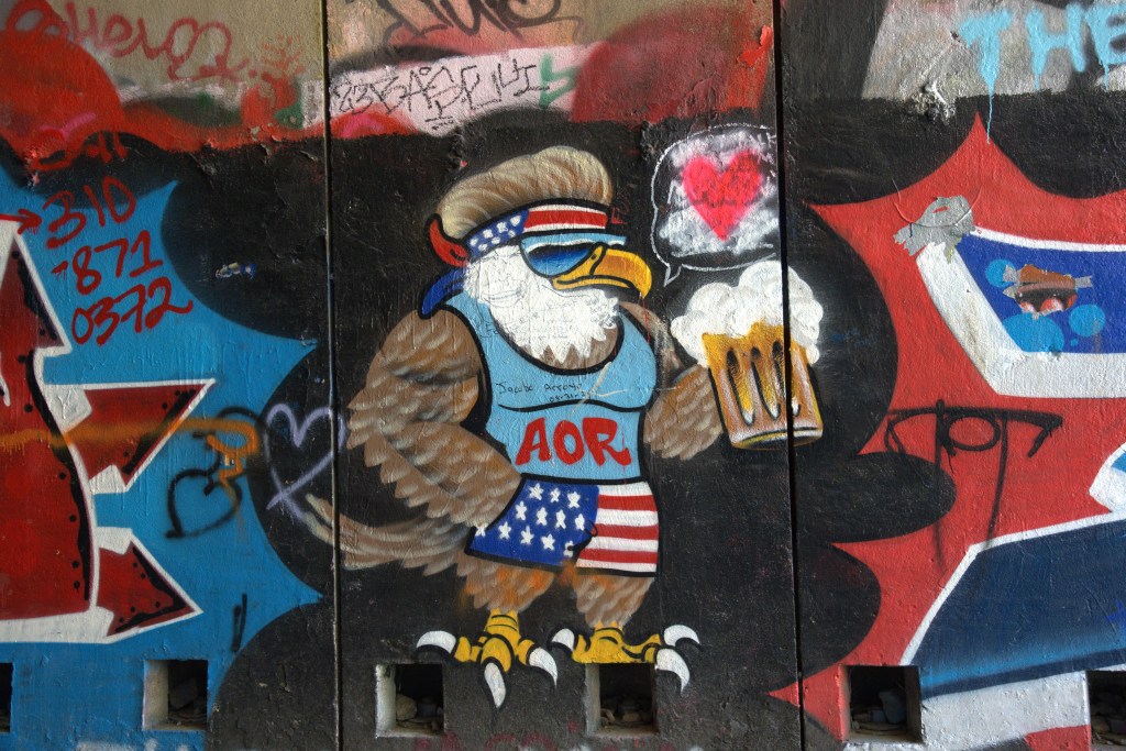
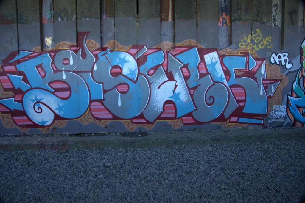
    And now for the street art. There are some amazing murals throughout the tunnels, almost all painted in the snow sheds. There is a lot of graffiti in the tunnels, but most are just scrawls on the dimly lit, rough rock walls. I was amazed at how high up some of the art and graffiti was upon the concrete walls – a very large ladder would have been necessary to reach that high. Some of the murals must have taken a day or two complete – some had a base color painted across large sections of the walls. The artists clearly had a plan, and must have brought a lot of paint and equipment along, not just a few cans of spray paint. It’s a shame that so much of this work has been covered over with graffiti. You can see that on most of the photos below.

    Street Art Photo’s

    Most hikers turn back after emerging from the last snow shed – after 3 miles of walking on that rough gravel trail. staring at the ground in front of your feet in the dark to avoid tripping on rocks, and going blind going in and out of dark tunnels to bright sunlight, I had little enthusiasm for wandering down a dusty trail or hiking up higher. I was hoping there would be a couple of big rocks to sit on while taking in the view of Donner Lake, but there was not place to rest other than going back into the tunnel entrance. You’d think someone would have built a few benches! At least there was a path heading into some trees if you needed a bio break. 

    Walking back 3 miles through all the tunnels and sheds was not quite as exciting as exploring them on the way out. I had ditched the GoPro (into my pack) and did not make too many photo stops. I began to fantasize on finding a Dairy Queen close by to where we were parked. I had to settle for an It’s-it from a peculiar grocery store in Soda Springs on the way back to I-80. That hit the spot. 

    Hiking Past Tunnel 11

    FYI – The old railroad grade does continue on for miles, and eventually joins up with the active railroad line which runs through some of the old snow sheds and remaining tunnels (12-15). If you look on Google Maps/Earth, you can find tunnels 1-5 on the active rail line. I would not recommend walking through any of those. Aside from the fact that it is probably illegal, it’s scaring as hell if you are inside and the train goes by. I’ve had the experience in my rock climbing days in Colorado….trust me. Don’t do it.

    One other interesting point about this trail, noted by my friend, was the almost complete lack of trash along the entire three miles. I think I saw maybe two bottles the entire way. Either some group is coming by every now and then to pick up trash, or this hike seems to attract eco-friendly visitors. I even witnessed someone picking up and bagging their dogs poop. Amazing.

    References

    There are lots of YouTube videos and Web sites with information about the hike, including AllTrails. This is a good starting point https://tahoetrailguide.com/hiking-the-historic-donner-pass-train-tunnels-in-truckee-ca/

  • The Last Cave: Mercer Caverns

    Zoltar says “I see many stairs and great ice cream in your future”

    Even though I am free from the medical anchor which has kept me more or less close to home this summer, I’m still working on the local bucket list, and all I had was one last cavern to visit – Mercer Caverns. This one is close to the last one I toured (Moaning Caverns), so I got to drive through Murphy’s again. I like that town. Mercer Caverns pretty much has the same history as all the others along the Sierra foothills – it was discovered by a gold miner (Walter Mercer in this case) in the late 1800’s, who noticed a breeze coming out of the ground, dug a hole and found the cavern. He explored it with a geologist, who told him it was all limestone, so forget about finding gold. But as with the other caverns, Mr. Mercer decided to turn his worthless mining claim (which he bought for $1) into a money making tourist attraction. He died young after a bad fall in the cave, but his family and future owners continued to explore and upgrade the tourist route through the years. And much like some of the other caverns, the tour follows a series of steep stairs and narrow passages which lead to small rooms, each with interesting features which the tour guide points out. Kind of sounds repetitive, because it is. So I’ll try to keep this post relatively short for a change.

    I was by myself once again (sigh), so motored down to Murphy’s, arriving a few minutes after 11AM. This place does not take reservations – they are pretty casual about when the tours start, apparently based on when enough people show up. Today, they ran the tour at 11:30 as a few small groups showed up after I got there. I was planning to use the GoPro again to capture some video, and had the chest harness and camera setup, but was told that video cameras were not allowed. Huh? They mentioned that on their Website, but I assumed they were referring to the large cameras that serious videographers use, not a very small GoPro firmly attached to my body. Plus every phone and my, what they called a still camera, take high resolution videos. I asked why, and was told “that’s the rules”. No other explanation. Fine….I tossed the harness and camera back in the car. A very dumb rule.

    So, I got to the head of the line, and after a quick intro by the tour guide, down we went. This was the actual entry point that Mercer hacked out – you can see the hole from the first anchor he used to rope down the hole, next to the plaque.

    Photo of the entrance to the Mercer Cavern in Murphys CA

    The stairs leading down were quite steep and narrow, and not as well lit as in some of the other caves, but with solid railings to hold on to. There were also a few tight spots where taller people have to duck to avoid smashing your head. There were four or five landings on the tour where we stopped and gathered to view some of the classic features you see most caves – stalactites and stalagmites, columns, various flow features. Each of these rooms were fairly small, but were well lit to highlite the features.

     Because the rooms and passages were so narrow, the owners placed plexiglass protectors along the cave walls in a number of places, to keep visitors from touching anything. That made it difficult for photography, but I managed to get some good shots, mostly with my phone. I hardly used the Sony camera swinging around my neck (I really need to buy a harness for that thing).

    The very last stop had the one unique feature for this cavern – some incredibly delicate and beautiful aragonite crystals, which won a major award at the Paris Worlds Fair in 1900.

    After we reached that landing we headed back up, stopping for the traditional candle and lights-out display, and then continued climbing back up the 17 stories of stairs to the top. Phew.

    I’m totally caved out now – this was a nice tour – great tour guide, nice people in the shop (that’s where Zoltan resides). But after four other tours, the aragonite crystals were the only feature that stood out for me. And I was a bit annoyed with the slightly rude response I received by one of the staff about why I could not use the GoPro camera (“cause it’s the rules”). Whatever. It was an enjoyable outing.

    The Website for Mercer Caverns has quite a bit of detail on the history and geology of the caverns.

    http://mercercaverns.net/index.html

    I hung around, waiting for my heart beat to climb down to normal after the climb out, and then headed home. But, I just had this absolutely desperate need for ice cream. Fortunately, there are two shops on Main Street in Murphy’s, which I had to drive through, so I picked one…it was a vry good choice.

    No more caves for a while. There are caves in other parts of the state – Lava tubes around Mt Lassen and Lava Beds National Park, and a few around Sequoia National Park. I may eventually get to those. The only one I’m interested in now is Mitchell Caverns, in the Mojave Desert.