Winding, finding places to go And then one day, hooray! Another way for gnomes to say Oomray Oomray
The Gnome, Pink Floyd
Can I take him home?
It was hard to ignore the Grateful Gnome brew-pub after including a photo of it in my Gnome Confessions post, so I managed to slip a quick visit into my agenda for the trip, and made it there on the last day. It is located in West Denver, near a park I used to play tennis at (Berkeley Park), in a building that used to be an auto shop in another life. The gnomes did a great job converting into a restaurant and brewery. Busy little devils they are.
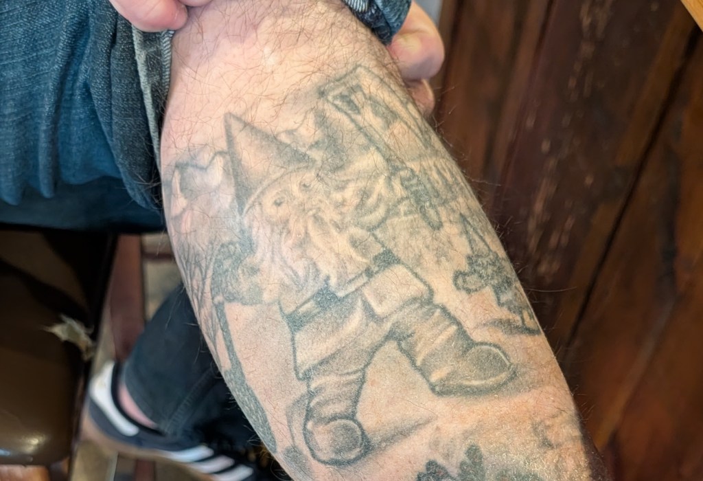
When we first entered (human sized, not the usual gnome cave entry), I asked what the story was about gnomes. The waitperson did not know, and pointed me over to the bar where the owner was sitting. About an hour later, we had learned the entire history of the bar, a bit of his family history, got to see a few of his gnome tattoo’s (picture below….really, I’m not making this up), and even got a tour of the small but incredible brewery in the back. The owner is a great person, fun to talk to and obviously really enjoys owning and managing the establishment – and a true gnome aficionado.
He has more than one….this was enough
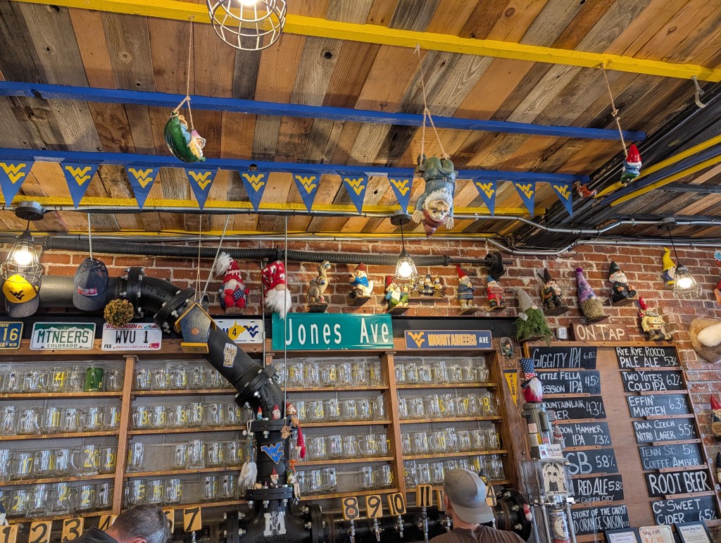
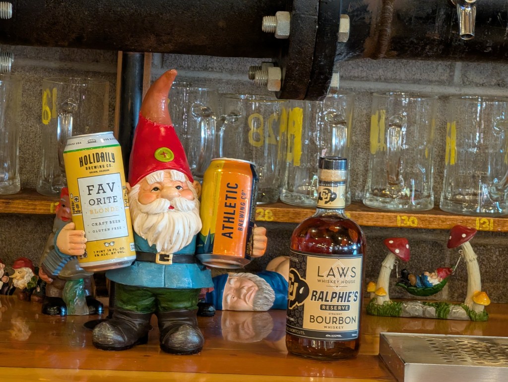
As for the gnome collection, mine pales in comparison. There are small gnomes, large gnomes, happy gnomes, beer can holder gnomes, gnomes on the walls, gnomes swinging from the ceiling, signage gnomes, gnomes on the beer taps – pretty much every kind of gnome that exists in the world.
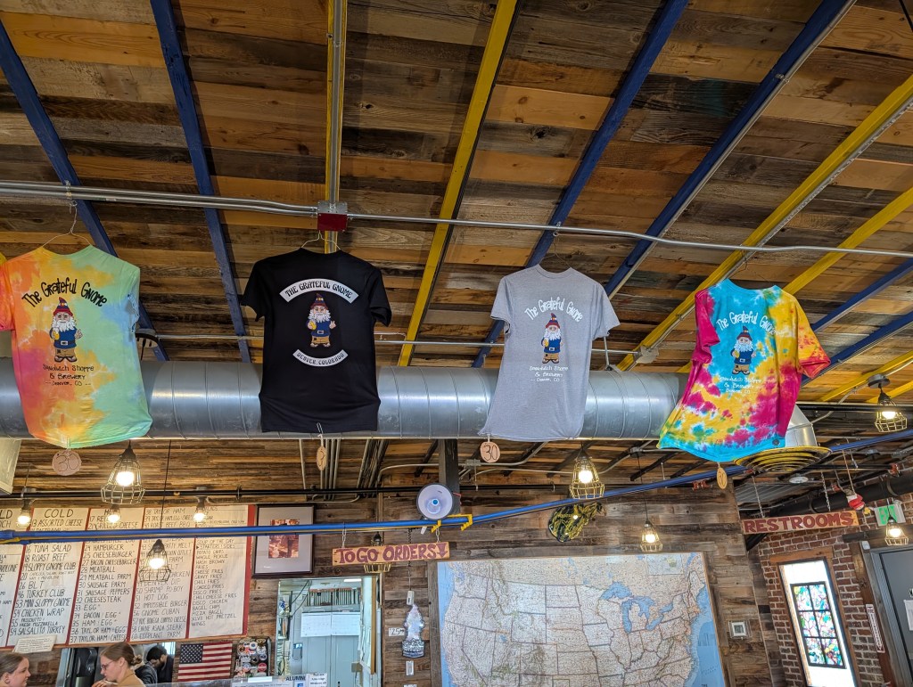
And there are gnome t-shirts of course – I almost gave in and bought one, but I was still depressed about not getting a Manitou Incline shirt or the popsicle…sigh. My glass is always half-empty.
I kind of liked the tie-dyed one
OK, I did not intend to make this an advertisement for the place, but I really enjoyed the time we spent there. The food is great – not really gnome themed, just a lot of deli and comfort food type sandwiches with a wide variety of sides. Good stuff. And as I mentioned, they also have a brewery in the rear of the building, making 12 custom brews. They have a small area packed with a lot of modern brewery equipment….and a really cool brew master.
And you do not have to worry about safety in that place – they have their own gnome-managed security service!
AI generated by me
This was the last entry on my Colorado trip agenda, and a fun and non-destructive one at that. No hiking or climbing involved, and I even got a tour of a part of Denver I’ve not seen in decades. Once upon a time, when we first moved to Denver (1979), there was an amusement park in that area (Elitch Gardens). It was torn down after closing in 1994, and the area is now housing and a ton of restaurants. But they left the original carousel dome and theater. A nice memory. There are so many of them in Colorado for me.
So I managed to hit everything I wanted to do, spent 10 days with friends instead of by myself (I had forgotten what it was like to talk to someone other than myself all day), bought what I needed for my Antarctica trip, ate too much and drank too much and maybe re-wired my brain a bit. Perfect trip.
And if you are in Denver and want to commune with gnomes:
Spoiler Alert: This is a long post so I thought it best to give the punch-line to start with. I MADE IT! And I’m still alive and in one piece. Just really sore.
I had a number of alternative titles for this post, and had a hard time deciding which was most appropriate
The Manitou Incline – Hiking for Masochists
The Manitou Incline – My Very Last Insane Hike
The Manitou Incline – Why?
The Manitou Incline – The Stairway to Not Heaven
The Old Man and the Stairs
Climbing the Manitou Incline has been on my bucket list for a while. I knew about it through all the years we lived in Colorado, but much like the Seven Falls and the Cave of the Winds, it was not a priority compared to all the other crazy things I did.
As always, a bit of history first. The Incline is the track of a cable tram, built in 1907 in support of a hydroelectric plant in Manitou Springs. It eventually became a tourist attraction until it was destroyed in 1990 by a rockslide. The rail path was eventually converted into the current hiking trail, which consists of wooden steps, 2768 of them, rising over 2000 feet from the base in about 1 mile. It tops out at 8590′ elevation. That’s very steep by the way. The top of the incline stairs has a link to the Barr Trail, which leads back to the starting point. So the overall round trip is about 5 miles. That does not seem so far until you do it.
There is no charge for hiking the Incline, oddly enough. You just have to reserve a time slot since the city manages how many hikers are on the trail at once. Parking in Manitou Springs is always a problem since it is a major tourist attraction – there is parking close by the start of the trail, but it is almost all reserved for the cog railroad to Pikes Peak or for hikers on the Barr Trail. The city has two larger parking lots further away, but has a free shuttle bus which drop you off near the trail head. The lots are reasonably priced.
My reservation was at 11AM, but with light Sunday traffic, I got to the parking lot early. While waiting for the shuttle, I realized that the big gash on the mountain side down the street was the Incline. It looked really steep.
The Incline in the distance
The bus was packed with hikers, most of whom were doing the Incline. As you can tell from the blue sky in the photo, it was a perfect Colorado fall day. Things were looking up. Literally.
The shuttle drops you off at the cog rail station, and you have a short uphill walk to the trail head following the signage. You first walk by a small shop, which had souvenirs, Incline themed t-shirts, snacks and best of all, those wonderful fruit popsicles I discovered at the Seven Falls. Yum. I was definitely going to make a stop when I was finished with the climb. Wishful thinking.
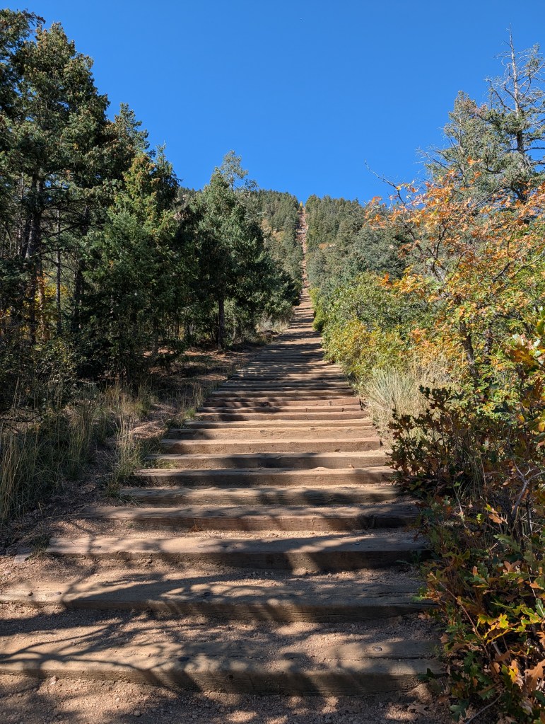
I was expecting to find someone checking reservations at the base of the trail – there were a lot of climbers milling around, but once we realized the little check-in building was closed, everyone just started up. The trail head was obvious.
It looks so easy from here
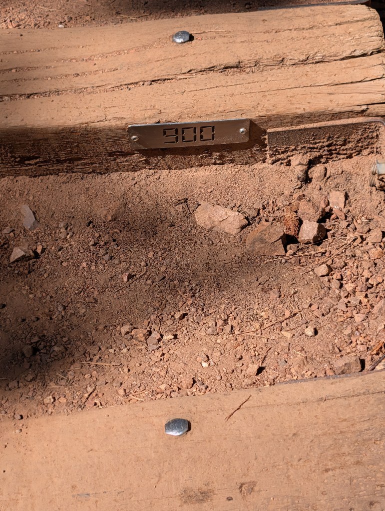
The sign at the bottom indicates the distances, elevation and the three bail-out points along the trail. Looking up at the steep climb, I took note of the last bail-outs. I was getting nervous about this – it looked really steep, and that was just to the false summit you see from that point. There was more over the horizon. I also noticed at that point the little marker on the first step – there is a number marker every 100 steps. Gives you something to look forward to. Or maybe they do that to get you depressed about how many you have left to climb. At this point, there were 2767 to go. Boo.
Only 2767 steps to go!
A few comments about the trail and the steps. From what you can tell in the photo of the trail head, you have lots of standard sized railroad timbers evenly spaced with some dirt packed in between. Easy walking, right? Wrong. That nice consistency lasted for about the first 100 steps. After that, as the slope varies between steep, very steep and ridiculously steep, the spacing decreases sometimes to inches, the size of the timbers varies and frequently, the steps are made of two timbers. As you move upslope, there are also water channels built of stacked timbers with a steel grating on top. What this all means is that it is that there is no consistency in what you are traveling on, so it is almost impossible to develop a routine gait. You might be walking along on steps spaced a foot apart, then reach a double step with a grate to step across, followed by steep, smaller timbers spaced an inch apart.
For me, and this is all about me of course, this was really difficult. With my big size 13 feet and poor balance, the inconsistent spacing and size made for a miserable climb. I was using one hiking pole, for balance and to push off of which helped a lot, but on the steeper section, I wound up crabbing up either with one hand or in some cases, climbing with all fours. I was not alone in doing that on the steep sections.
OK, now for some pictures and a blow-by-blow description of my journey up the stairs
The starting elevation was about 6200’ which I was used to after a week at altitude and doing some hiking. So I made pretty good progress at first where the steps were fairly consistent. I was snapping away with my phone, and took a picture of each step marker so I could document my progress.
The grade was starting to increase after a few hundred steps, but I made it to 500 in 22 minutes. Not too bad given the altitude. I was encouraged at that point. This was also the first bailout point. Not interested.
The slope started increasing, as was the elevation of course, and I made it though the next 300 steps in another 16 minutes. I was not setting a speed record, but I was keeping up a good pace. I did notice that most all the other climbers (I’m going to refer to this as a climb, not a hike) were much younger than me….a lot younger. Most of the crowd were in their 20’s, wearing running skins. Some were running up the stairs and even worse, there were people RUNNING DOWN the stairs. I was assuming most everyone would be taking the long Barr Trail back down.
At this point, the trail became much steeper, and the step spacing and height more inconsistent. The elevation gain was also much more obvious – at first, I was doing about 30 or 40 steps between resting a few minutes. Pretty soon, that was down to about 20. And eventually 10.
I reached step 1200 in another 16 minutes, still trucking along at a reasonable pace – almost 19 steps per minute. I started out at close to 23, so not so bad. The steps were still consistent, but the trail ahead was getting steeper, and you could see everyone was laboring a bit. At step 1300, there was another bail out point – this was the last one that went off to a side trail, which went directly down to the starting point. After this, the bailouts connected to the longer Barr Trail.
You can see one of those water channels with the steel grating. These were more frequent the higher we climbed. I really disliked them.
At step 1500, my rate was dropping, down to 12/minute, and 1600, even worse at 10/minute. It was getting really steep, the altitude higher, and my energy levels much lower.
You can see how steep it was getting at this point. I was beginning to doubt my conditioning (and sanity) and thinking about the last bail-out spot which was coming up soon.
When I reached the bail-out, at 1850 steps, I was down to a 7/minute rate since I was taking breathers every few steps. I saw someone pull out one of those small oxygen canisters, and wish I had bought one or two. The bail-out was where you join up with the Barr Trail, so you have an hour hike back down. There was even a nice bench to sit on to ponder my future. It was a tough choice since I was more than half-way there, but more than half-way exhausted. I could hear Jan saying – head down idiot before your hurt yourself. But I decided to ignore my better half (and senseability) and truck on.
Last chance to bail out
So now there was no going back, or at least no easy way. I’d have to work my way down the steep stairs back to the bail-out. Not a good plan.
At step 1900, the trail was getting ridiculously steep, and I had to start crabbing my way. My forward progress was down to 10/minute.
Where it really got hard
It got worse at 2000 – this is where the small logs with little spacing become more like a ladder and I had to climb with all fours. Not fun.
My rate to that point was down to 5. Really slow.
Misery steps for big feet
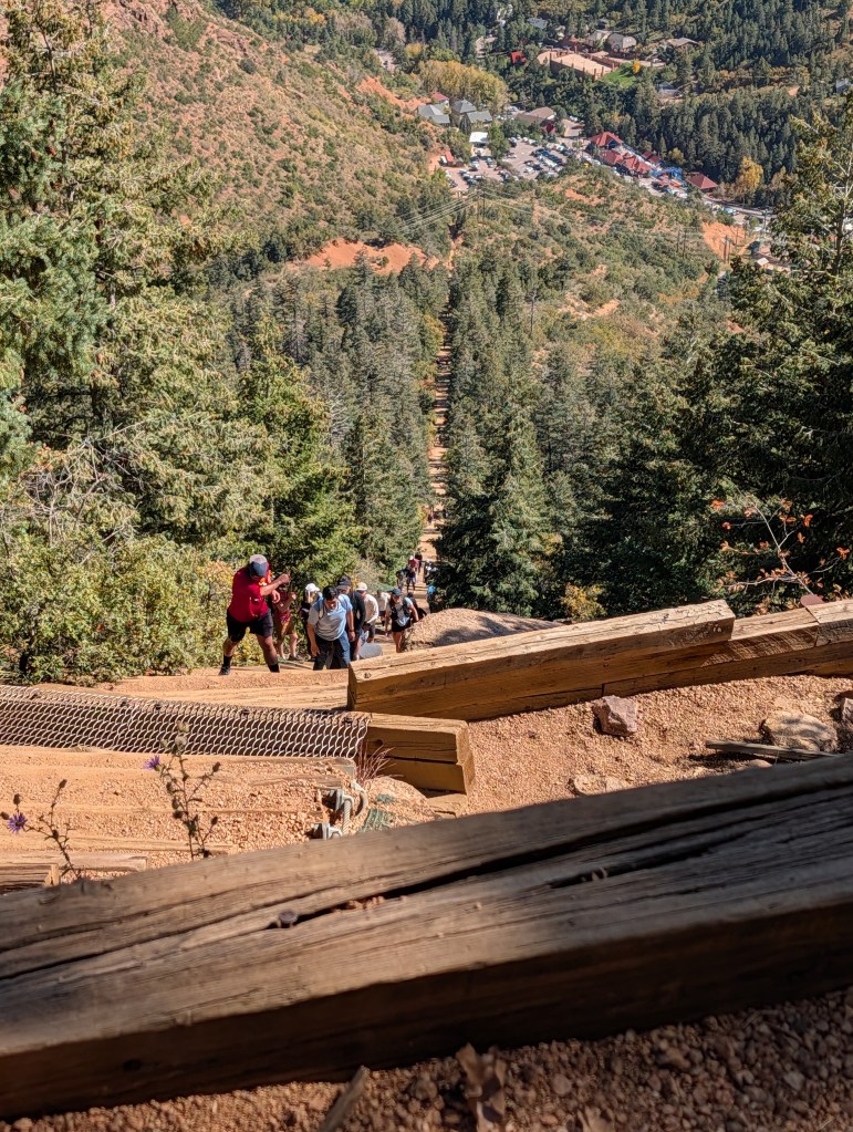
Thankfully at about this point, I had hit the false summit where the slope leveled out a little. It was a real relief for me because I was getting woozy from the effort and altitude. But I knew I could not go back, and I was less than 700 steps away from the end. By step 2200, the end was in sight. Hallelujah!
The home stretch from 2500
By step 2500, I could almost taste it…I was going to make it. I was back up to 17 steps/minute. But then I hit the last steep section. Of course that had to happen. But I was a man on a mission. I just counted 10 steps, rested a few seconds, and then pushed on until I made it to step 2600. Then I started counting each step since there were only 178 left to go. Some younger couple passed me and told me they were watching from behind and thought I was doing great. I guess I should not think of it as trying to encourage the old man. I thanked them.
Almost there!!!!
It was 2:05PM at step 2700. I took a deep breath and trucked on – 5 minutes later, I made it to the end. Woo Hoo!!!!
Absolutely exhausted, but feeling pretty good to be milling around with everyone else that had made it to the top. There were all kinds of places to sit, so I found a good one, dropped my pack, took a few selfies, and settled down to rehydrate and eat a power bar. It was getting late, and the temperature was dropping at 8500’, so I did not want to linger too long. I was also afraid I’d stiffen up if I rested too long.
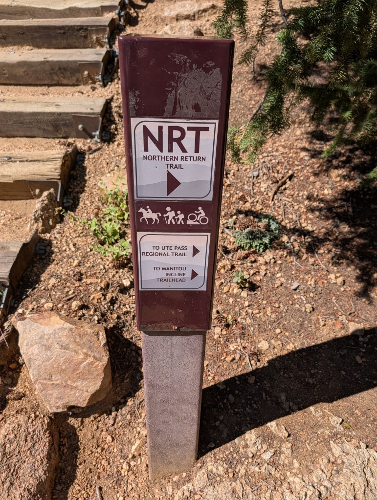
The Easy Trail Back
I’ve found that the return portion of any hike can be the most difficult. Depending on the difficulty of reaching your destination, the excitement of the hike/climb wears off, you may be tired and dehydrated, and all you want to do really is get to the end and have some ice cream or a beer. Well, all of the above fit my current state of body and mind. I was wishing Uber had a helicopter, or there was a zip line going back down above the stairs. No such luck. Four miles on switch backs, and a somewhat rocky trail. I was tired, and one of my knees was sore, but there was no choice but to head over to the start of the trail down.
A nice sign pointing the way back
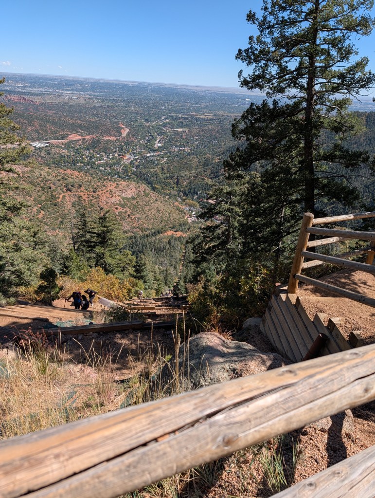
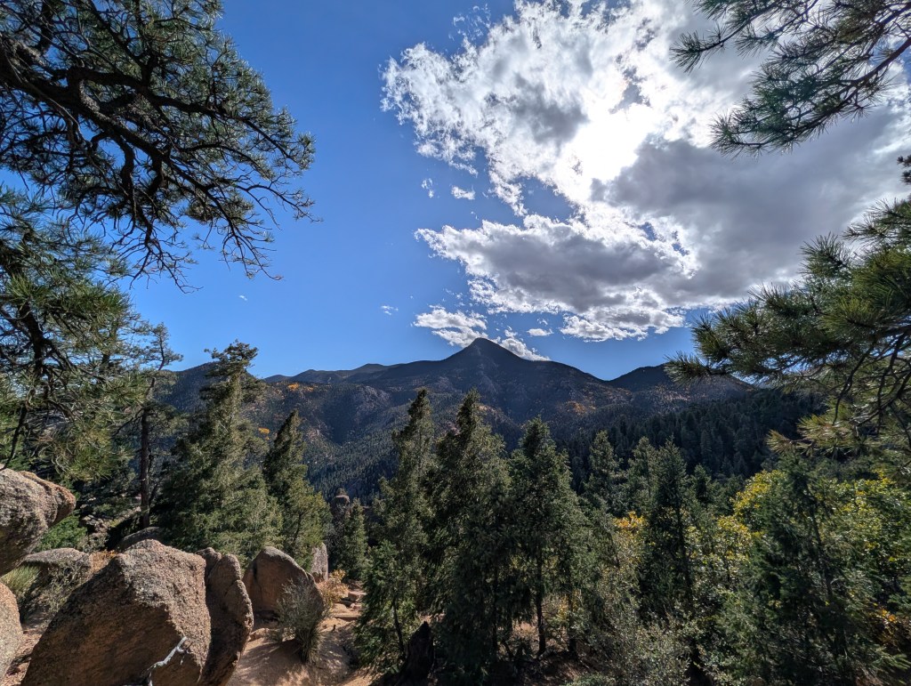
The trail was well marked and maintained, but there were a lot of steps and rocks to negotiate. Normally, that would not be too hard for me, but going downhill is hard on my bad knee, and I had to be extremely careful not to trip and lose my balance. I stopped along the way to take a few photos – nice scenery so I could not resist.
The trail seemed to go on forever. When I finally saw the tracks for the cog railroad I knew I was getting close to the end, and then I saw the Barr Trail parking lot.
Paradise so close, yet so far away
It still seemed like I was approaching the end as a limit – getting close but never quite getting there. But finally, it did end, and I limped a short distance downhill to the shuttle stop. It was about 5PM by then, and I no longer had an interest of walking back up to that small shop to buy a T-shirt and the fruit popsicle. My legs felt like mush, and all I wanted to do was get to the car and head back to Denver before my body seized up. Besides, there was great beer on tap at my friends’ house.
Some Final Thoughts
It was quite a day…and I was glad that it was over and did not fall and injure myself. I really was not in shape for this adventure, and pushed myself to my limits to get to the top. I did learn something from this – I’m 73 going on 74, and have some medical issues which I have to consider when signing up for adventures like this. Also, I’m living by myself now – Jan was used to ferrying me off to emergency clinics when I injured myself, and took care of me when I did stupid things. I don’t have that anymore. I stay off of ladders at home for that reason, so I needed to apply that common sense to my outdoor adventures.