Tag: Solo-travel

  • A Trip To Nowhere, And A Really Big Rock

    All roads lead to nowhere

    I had planned this adventure well before my recent trip to Colorado – Mitchell Caverns was the next to last on my Cave-A-Week tour, and while I was in the vicinity of Sequoia National Park, I figured I could cross Moro Rock off my bucket list, another hike with a bunch of steps. Is this becoming yet another obsession? Moi? Obsessive? Never. I guess I’ll never learn. 

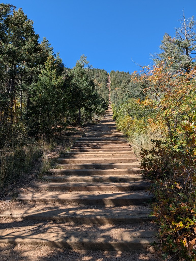
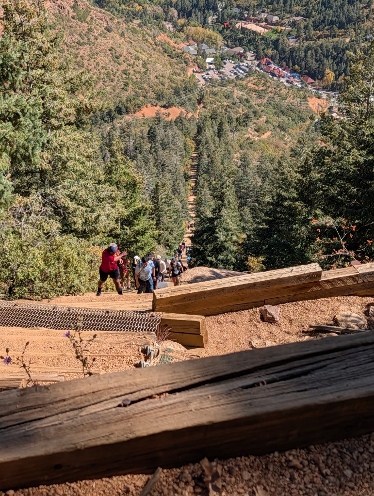
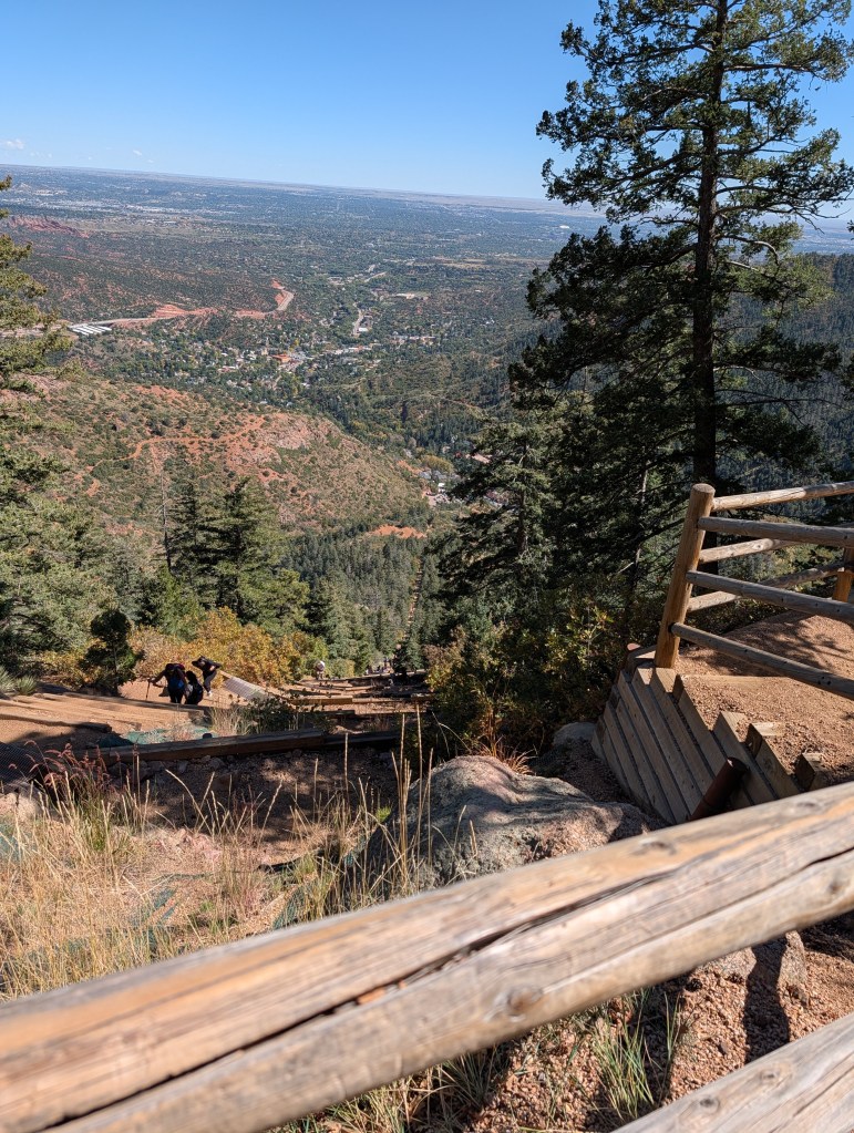
    Fortunately, neither of these little adventures were anywhere near as physically destructive or death defying as the Manitou Incline. But I have to wonder why I decided to do a very long car trip so soon after returning from Colorado (one week). Mitchell Cavern is out in the middle of the Mojave Desert (“The Middle of Nowhere” defined), a 4 hour drive from Bakersfield, which is a 4.5 hour drive from home. There are places to stay in Barstow (only 2 hours from the cavern), but I’m just not into 2 star motels anymore. So I planned on using a nice hotel in Bakersfield as my base, driving 4 hours for a 1 hour cave tour, and then returning back to Bakersfield afterwards. Dumb. What could possibly go wrong with that?  And the next morning, my plan was to drive to Sequoia National Park to hike Moro Rock (2+ hour drive), check out some other touristy spots (more big trees), and then spend the night at another Hilton Hotel in Fresno. Another 2+ hour drive. That leaves me with a 3.5 hour drive home on Monday. Phew. Enough of the introduction…on to the details. 

    Spoiler Alert – Success, but exhausted

    A Cave Way Too Far

    OK, I need to enroll myself in a “Cavern Tour Anonymous”  program. The Cave of the Winds in Colorado likely pushed me into the obsession level, but at least it was only an hour or so drive from where I was staying, in the middle of a major tourist destination. I drove for over eight hours round trip for a 60 minute tour in a relatively small cavern. The tour ended a bit after 3PM, so along with an 18 mile drive on a rutted road to get back to the highway, I wound up driving down a winding mountain highway in the dark, battling big rigs for the left lane, for the last two hours of my ride back to Bakersfield. Ugh. 

    But, the cave was interesting. It is the only public accessible cavern in California that is a state park, all the rest are privately owned except for the one, Crystal Cavern in Sequoia National Park (still on my bucket list). The drive from anywhere to this place is long and once you get off the highway, you are on a rough but mostly paved road which splits off to some interesting camping areas. The cavern was developed by a couple (Jack and Ida Mitchell), who purchased the area with a mining claim, but like most every other cavern I’ve been to this year, they quickly realized there was more value in developing a tourist attraction.

    The state park staff lives on-site in the original stone buildings – there’s a small visitor center, a camping area and restrooms with running water. And a pay phone kiosk next to the restrooms. I think it still works. It may be the last one in the state. Maybe the country.

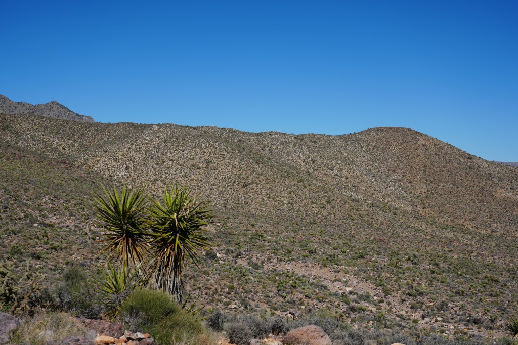
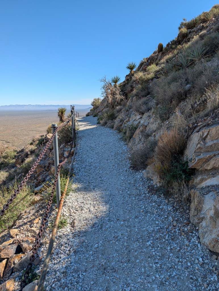
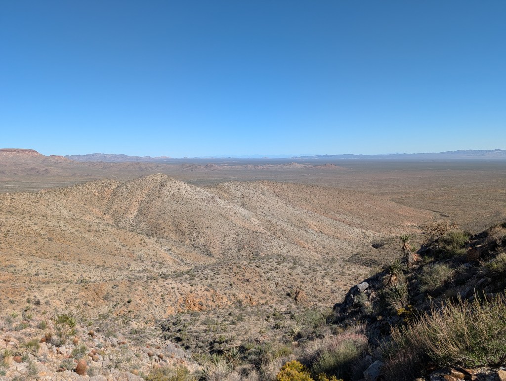
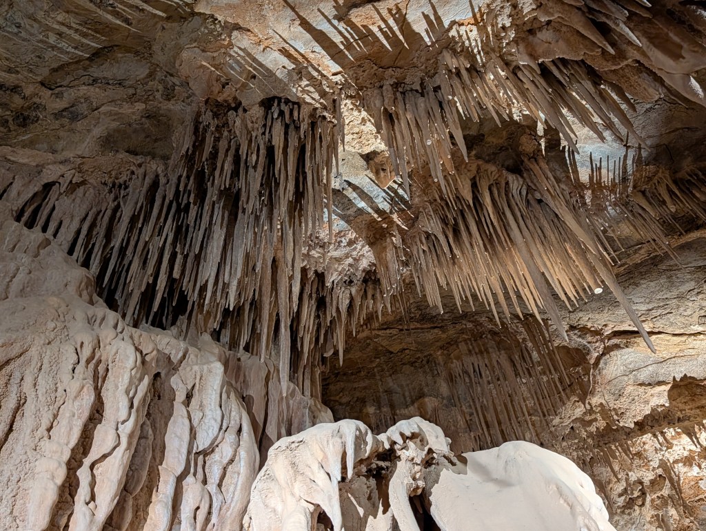
    There is a half-mile hike down a well maintained trail, mostly level, which has a bridge constructed across a deep wash. Incredible views of the desert. As you approach the bridge, you get your first view of the entry to the cavern. As it turns out there is one at the other end of the tour. This is actually a small cavern compared to the complex ones I’ve been to across the state. There are only a few rooms, and at the end, you can either exit there and walk back along the trail, or just trace your steps back to where we entered. It would be really hard to get lost in this cave. Unless the lights go out.

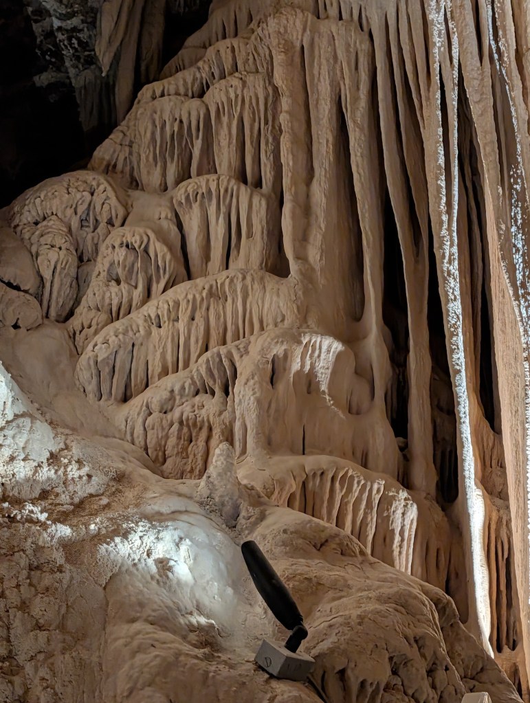
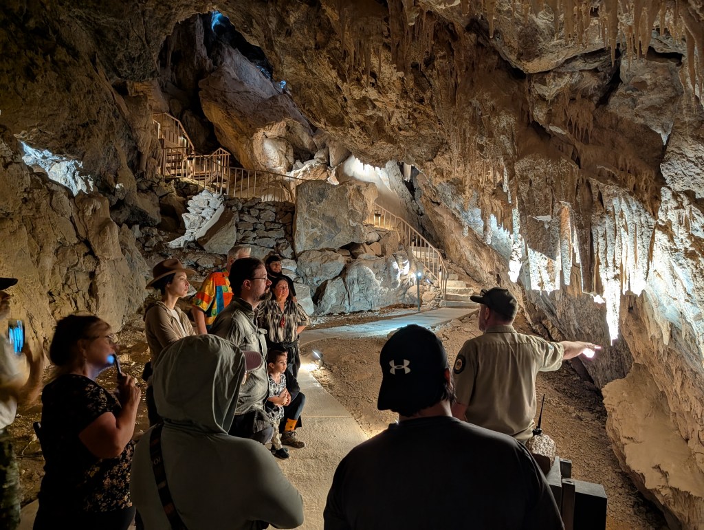
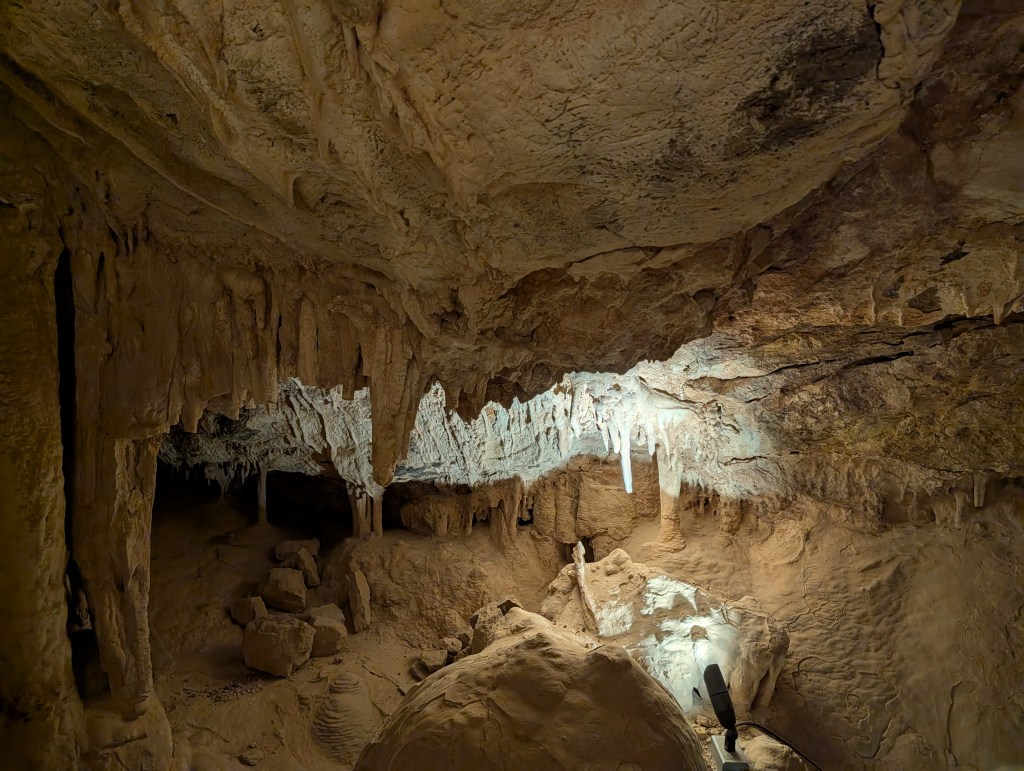
    The tour guide was a State Park employee, and knew the history, geology and then some, about the cave. The features were for the most part, the same as what you see in any cave. The big difference is that this one is really old – 20 million years, and also dry. It is in the latter stage of cave life, where nothing is growing, but things are starting to break – many of the stalactites are stubbed off. You don’t see that many in younger caves. The tour guide also discussed some microbiology topics which I had never heard about and which I’m now reading about. Mind blowing stuff.

    The other peculiar difference with this cave was that it was actually two different caves. The Park Service drilled a passage between the main cave, and a small, south facing one a few decades ago. The smaller had been used by humans in the past for storage, and was also frequented by ice age beasties. But since it had a south face, it was always warmer, and the temperature difference created a pressure differential, which created a breeze heading into the main cavern. This blew a lot of dust in, and also impacted the overall environment in the main cavern. So, the Park Service eventually installed steel doors at either end of the connection tunnel, Something else I’ve never seen before. 

    The other nice feature in this cave was the lighting – lots of it. The guide was constantly hitting switches along the way. I spent a lot of time figuring out how to capture video on the GoPro camera in low lighting, but did not really need it. 

    And now, for a bunch of photo’s

    The tour ended about 3:00PM, and the walk back to the visitor center was pretty quick. My Forest Gump brace and new hiking shoes, made a big difference in my stability on a trail. I started my drive back to Bakersfield about 3:30PM and made it back after 8PM. If you’ve ever traveled that route, there’s a long uphill and downhill stretch from Barstow to Bakersfield. Not so bad during the day, really tough in the dark when you are tired. Most of the traffic is tractor-trailers. I was really glad to make it back to the hotel. Totally exhausted. A warm Doubletree chocolate chip cookie, followed by a couple of beers helped. Dinner was pretty good too.

    If you are interested in driving to this obscure spot (there are other things to see in the middle of nowhere), here is good site to start with.

    Update: Oddly enough, the San Francisco Chronicle had an article on the Mitchell Caverns in the Sunday paper today (10/26). Maybe the author read this blog?

    I’ve got one more cavern on my California list – Crystal Cavern. It is closed until next summer. That’s a good thing.

    Moro Rock and Gross Bathrooms

    Moro Rock

    In case you are concerned about the title, I did not include any photos in this post of the bathrooms in the national park, nor will I spend much time describing them. Driving interstate highways, and visiting national parks during a government shutdown does make for some interesting and annoying challenges. I have traveled down I-5 and I-15 numerous times, and have regular pit stops along the way. Unfortunately, all the rest stops along the interstates are closed during shutdowns. That really changes everything for older folks who need to stop every 2-3 hours for bio breaks (I know, TMI). What’s definitely worse, are the bathrooms, mostly outhouses, in national parks. During one of the past shutdowns, I visited Joshua Tree. You could not get within 50 yards of any of the outhouses after a week. There was a dead zone of wildlife around each from the odor. Sequoia was just about at that point. But at least the park was open. And there are a lot of really big trees to hide behind – lots of privacy just off the road. 

    Jan and I visited Sequoia the first year we lived in the South Bay. I don’t remember too much about the trip – we stayed in Visalia, and spent one day in the park, just a quick in and out in the northern section. This time I entered through the south end, which seemed to be where most of the large groups of visitors were coming from. Free entry for all (I have one of the permanent senior passes). Without a park map, I had to rely on Google and Android Auto, which tends to not work too well when the internet fades in and out. But, there is just one main road running through the park, so it was not too tough figuring out how to get to Moro Rock. Why was I going there? Beats me. It just seemed like a nice hike, lots of steps, but nothing like the Manitou Incline. 

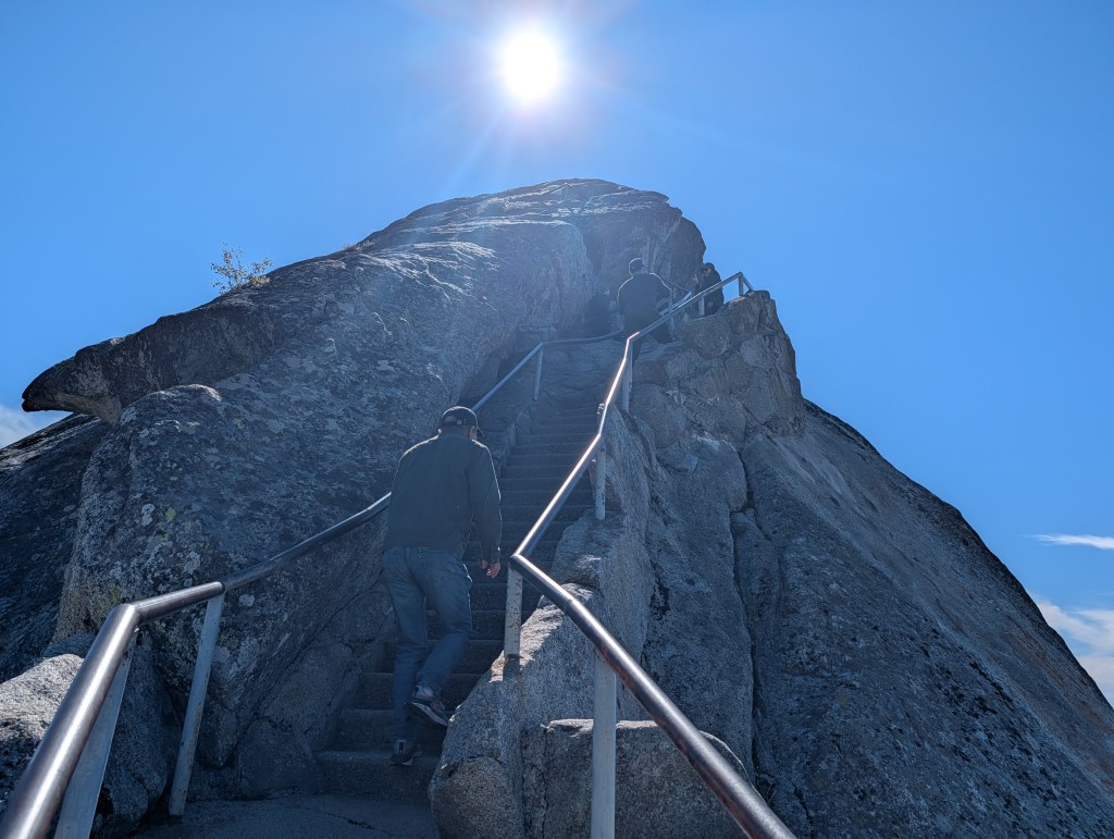
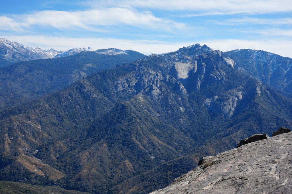
    I caught sight of this huge granite outcrop early on, and figured that had to be my destination. Getting there was fun – a seemingly endless number of sharp switchbacks, with lots of traffic. I eventually made it to the narrow side roads leading to the trail head parking lot, and found a close spot for the Subaru. And there was one of those toxic outhouses there. Safe for guys only. 

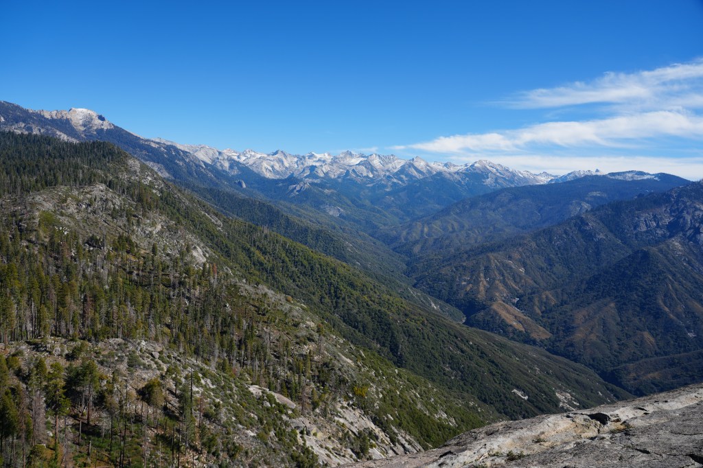
    Moro Rock is definitely one of the most interesting hikes I’ve been on. I do not know much about the history of the trail construction, but some genius engineer made a 5th-class rock climb into a relatively easy, family oriented hike to one of the most stunning overlooks I’ve been to. Sort of like Half-Dome with training wheels. There are 400 steps plus ramps, and railing going up 300’ to a narrow slice of granite, with absolutely incredible views of the surrounding peaks and lower valleys. It is a challenge for some since you are hiking at 6000’, and the exposure probably scares some folks off. But there were gobs of people, some with small children, making their way up to the top.

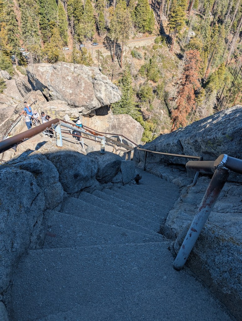
    After spending time at altitude in Colorado, this was a snap for me, especially with my Forest Gump brace and brand new hiking shoes. Having a stable base really helps. It was amazing on top – very narrow, with a line of people waiting to take selfies and group shots at the narrow end. What amazed me was the warning sign on the railings.

    Was this really necessary? They might have just posted a sign. “Don’t jump off the edge -you will die”. 

    Moro Rock

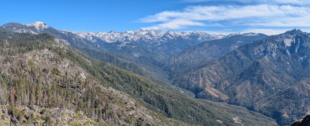
    I spent a lot of time taking in the view. It was stunning. I had a strange moment or two, but I’ll describe that in the journal. Overall, a great hike. The view from the top was beyond impressive.

    Moro Rock
    Moro Rock

    I was pretty much ready to head back home after making it down through the crowd heading up. I stopped at a few of the tourist spots, and shot a few pictures of the big trees. Definitely more of them here than in the state park I visited a few weeks ago. What was also amazing were the burned areas – there are huge sections of torched forest throughout the park. Most of the sequoias have burn marks at the base of the trees. The Forest Service and fire crews did an amazing job of saving these incredible trees. 

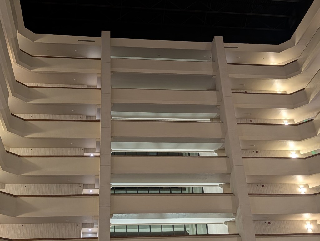
    I had booked a hotel in Fresno when I scheduled this trip, thinking that I would be too pooped from hiking to drive the 4 hours back home from Sequoia. Smart move on my part. I was doing OK and made it to the hotel by 5PM, but I was still tired from all the driving back and forth to the cave. And this turned out to be a really nice hotel. I did not have breakfast or lunch that day, other than a bag of M&M’s, so I made up for lost time at the bar. I do not usually include photo’s from a hotel, but this one (Doubletree Fresno) is pretty amazing.

    Overall, it turned into a pretty good trip. But this much driving in three days? Not going to do that again. I plan on taking it easy the next few weeks, before the Antarctica trip in November. I need to be in shape for fighting off the hordes of giant penguins. I wonder if there are any gnomes down there? I hope not.

  • The Manitou Incline – 2768 Steps, all of them painful

    Manitou Incline

    Spoiler Alert: This is a long post so I thought it best to give the punch-line to start with. I MADE IT! And I’m still alive and in one piece. Just really sore.

    I had a number of alternative titles for this post, and had a hard time deciding which was most appropriate

    The Manitou Incline – Hiking for Masochists

    The Manitou Incline – My Very Last Insane Hike

    The Manitou Incline – Why?

    The Manitou Incline – The Stairway to Not Heaven

    The Old Man and the Stairs

    Climbing the Manitou Incline has been on my bucket list for a while. I knew about it through all the years we lived in Colorado, but much like the Seven Falls and the Cave of the Winds, it was not a priority compared to all the other crazy things I did.

    As always, a bit of history first. The Incline is the track of a cable tram, built in 1907 in support of a hydroelectric plant in Manitou Springs. It eventually became a tourist attraction until it was destroyed in 1990 by a rockslide. The rail path was eventually converted into the current hiking trail, which consists of wooden steps, 2768 of them, rising over 2000 feet from the base in about 1 mile. It tops out at 8590′ elevation. That’s very steep by the way. The top of the incline stairs has a link to the Barr Trail, which leads back to the starting point. So the overall round trip is about 5 miles. That does not seem so far until you do it.

    There is no charge for hiking the Incline, oddly enough. You just have to reserve a time slot since the city manages how many hikers are on the trail at once. Parking in Manitou Springs is always a problem since it is a major tourist attraction – there is parking close by the start of the trail, but it is almost all reserved for the cog railroad to Pikes Peak or for hikers on the Barr Trail. The city has two larger parking lots further away, but has a free shuttle bus which drop you off near the trail head. The lots are reasonably priced.

    My reservation was at 11AM, but with light Sunday traffic, I got to the parking lot early. While waiting for the shuttle, I realized that the big gash on the mountain side down the street was the Incline. It looked really steep.

    Manitou Springs, Colorado
    The Incline in the distance

    The bus was packed with hikers, most of whom were doing the Incline. As you can tell from the blue sky in the photo, it was a perfect Colorado fall day. Things were looking up. Literally.

    The shuttle drops you off at the cog rail station, and you have a short uphill walk to the trail head following the signage. You first walk by a small shop, which had souvenirs, Incline themed t-shirts, snacks and best of all, those wonderful fruit popsicles I discovered at the Seven Falls. Yum. I was definitely going to make a stop when I was finished with the climb. Wishful thinking.

    I was expecting to find someone checking reservations at the base of the trail – there were a lot of climbers milling around, but once we realized the little check-in building was closed, everyone just started up. The trail head was obvious.

    Manitou Incline
    It looks so easy from here

    The sign at the bottom indicates the distances, elevation and the three bail-out points along the trail. Looking up at the steep climb, I took note of the last bail-outs. I was getting nervous about this – it looked really steep, and that was just to the false summit you see from that point. There was more over the horizon. I also noticed at that point the little marker on the first step – there is a number marker every 100 steps. Gives you something to look forward to. Or maybe they do that to get you depressed about how many you have left to climb. At this point, there were 2767 to go. Boo.

    Manitou Incline
    Only 2767 steps to go!

    A few comments about the trail and the steps. From what you can tell in the photo of the trail head, you have lots of standard sized railroad timbers evenly spaced with some dirt packed in between. Easy walking, right? Wrong. That nice consistency lasted for about the first 100 steps. After that, as the slope varies between steep, very steep and ridiculously steep, the spacing decreases sometimes to inches, the size of the timbers varies and frequently, the steps are made of two timbers. As you move upslope, there are also water channels built of stacked timbers with a steel grating on top. What this all means is that it is that there is no consistency in what you are traveling on, so it is almost impossible to develop a routine gait. You might be walking along on steps spaced a foot apart, then reach a double step with a grate to step across, followed by steep, smaller timbers spaced an inch apart. 

    For me, and this is all about me of course, this was really difficult. With my big size 13 feet and poor balance, the inconsistent spacing and size made for a miserable climb. I was using one hiking pole, for balance and to push off of which helped a lot, but on the steeper section, I wound up crabbing up either with one hand or in some cases, climbing with all fours. I was not alone in doing that on the steep sections. 

    OK, now for some pictures and a blow-by-blow description of my journey up the stairs

    The starting elevation was about 6200’ which I was used to after a week at altitude and doing some hiking. So I made pretty good progress at first where the steps were fairly consistent. I was snapping away with my phone, and took a picture of each step marker so I could document my progress.

    The grade was starting to increase after a few hundred steps, but I made it to 500 in 22 minutes. Not too bad given the altitude. I was encouraged at that point. This was also the first bailout point. Not interested.

    The slope started increasing, as was the elevation of course, and I made it though the next 300 steps in another 16 minutes. I was not setting a speed record, but I was keeping up a good pace. I did notice that most all the other climbers (I’m going to refer to this as a climb, not a hike) were much younger than me….a lot younger. Most of the crowd were in their 20’s, wearing running skins. Some were running up the stairs and even worse, there were people RUNNING DOWN the stairs. I was assuming most everyone would be taking the long Barr Trail back down. 

    At this point, the trail became much steeper, and the step spacing and height more inconsistent. The elevation gain was also much more obvious – at first, I was doing about 30 or 40 steps between resting a few minutes. Pretty soon, that was down to about 20. And eventually 10.

    I reached step 1200 in another 16 minutes, still trucking along at a reasonable pace – almost 19 steps per minute. I started out at close to 23, so not so bad. The steps were still consistent, but the trail ahead was getting steeper, and you could see everyone was laboring a bit. At step 1300, there was another bail out point – this was the last one that went off to a side trail, which went directly down to the starting point. After this, the bailouts connected to the longer Barr Trail.

    You can see one of those water channels with the steel grating. These were more frequent the higher we climbed. I really disliked them.

    At step 1500, my rate was dropping, down to 12/minute, and 1600, even worse at 10/minute. It was getting really steep, the altitude higher, and my energy levels much lower.

    You can see how steep it was getting at this point. I was beginning to doubt my conditioning (and sanity) and thinking about the last bail-out spot which was coming up soon.

    When I reached the bail-out, at 1850 steps, I was down to a 7/minute rate since I was taking breathers every few steps. I saw someone pull out one of those small oxygen canisters, and wish I had bought one or two. The bail-out was where you join up with the Barr Trail, so you have an hour hike back down. There was even a nice bench to sit on to ponder my future. It was a tough choice since I was more than half-way there, but more than half-way exhausted. I could hear Jan saying – head down idiot before your hurt yourself. But I decided to ignore my better half (and senseability) and truck on.

    Manitou Incline
    Last chance to bail out

    So now there was no going back, or at least no easy way. I’d have to work my way down the steep stairs back to the bail-out. Not a good plan.

    At step 1900, the trail was getting ridiculously steep, and I had to start crabbing my way. My forward progress was down to 10/minute.

    Manitou Incline
    Where it really got hard

    It got worse at 2000 – this is where the small logs with little spacing become more like a ladder and I had to climb with all fours. Not fun.

    My rate to that point was down to 5. Really slow.

    Manitou Incline
    Misery steps for big feet

    Thankfully at about this point, I had hit the false summit where the slope leveled out a little. It was a real relief for me because I was getting woozy from the effort and altitude. But I knew I could not go back, and I was less than 700 steps away from the end. By step 2200, the end was in sight. Hallelujah!

    Manitou Incline
    The home stretch from 2500

    By step 2500, I could almost taste it…I was going to make it. I was back up to 17 steps/minute. But then I hit the last steep section. Of course that had to happen. But I was a man on a mission. I just counted 10 steps, rested a few seconds, and then pushed on until I made it to step 2600. Then I started counting each step since there were only 178 left to go. Some younger couple passed me and told me they were watching from behind and thought I was doing great. I guess I should not think of it as trying to encourage the old man. I thanked them. 

    Manitou Incline
    Almost there!!!!

    It was 2:05PM at step 2700. I took a deep breath and trucked on – 5 minutes later, I made it to the end. Woo Hoo!!!!


    Absolutely exhausted, but feeling pretty good to be milling around with everyone else that had made it to the top. There were all kinds of places to sit, so I found a good one, dropped my pack, took a few selfies, and settled down to rehydrate and eat a power bar. It was getting late, and the temperature was dropping at 8500’, so I did not want to linger too long. I was also afraid I’d stiffen up if I rested too long.

    The Easy Trail Back

    I’ve found that the return portion of any hike can be the most difficult. Depending on the difficulty of reaching your destination, the excitement of the hike/climb wears off, you may be tired and dehydrated, and all you want to do really is get to the end and have some ice cream or a beer. Well, all of the above fit my current state of body and mind. I was wishing Uber had a helicopter, or there was a zip line going back down above the stairs. No such luck. Four miles on switch backs, and a somewhat rocky trail. I was tired, and one of my knees was sore, but there was no choice but to head over to the start of the trail down.

    Manitou Incline
    A nice sign pointing the way back

    The trail was well marked and maintained, but there were a lot of steps and rocks to negotiate. Normally, that would not be too hard for me, but going downhill is hard on my bad knee, and I had to be extremely careful not to trip and lose my balance. I stopped along the way to take a few photos – nice scenery so I could not resist.

    The trail seemed to go on forever. When I finally saw the tracks for the cog railroad I knew I was getting close to the end, and then I saw the Barr Trail parking lot.

    Manitou Springs
    Paradise so close, yet so far away

    It still seemed like I was approaching the end as a limit – getting close but never quite getting there. But finally, it did end, and I limped a short distance downhill to the shuttle stop. It was about 5PM by then, and I no longer had an interest of walking back up to that small shop to buy a T-shirt and the fruit popsicle. My legs felt like mush, and all I wanted to do was get to the car and head back to Denver before my body seized up. Besides, there was great beer on tap at my friends’ house. 


    Some Final Thoughts

    It was quite a day…and I was glad that it was over and did not fall and injure myself. I really was not in shape for this adventure, and pushed myself to my limits to get to the top. I did learn something from this – I’m 73 going on 74, and have some medical issues which I have to consider when signing up for adventures like this. Also, I’m living by myself now – Jan was used to ferrying me off to emergency clinics when I injured myself, and took care of me when I did stupid things. I don’t have that anymore. I stay off of ladders at home for that reason, so I needed to apply that common sense to my outdoor adventures.

    But all things considered….I did it!

    Some useful links:

    Info on the Incline

    Manitou Springs & Reservations

    And for anyone interested in technical details

    I played around with my climb rates (Steps/Minute) for the fun of it

    Step #TimeMinutes to reachStep Rate
    Start10:38

    50011:000:2222.73
    80011:160:1618.75
    90011:250:0911.11
    120011:410:1618.75
    150012:070:2611.54
    160012:170:1010
    180012:450:287.14
    190013:030:185.56
    200013:140:119.09
    220013:300:1612.5
    250013:470:1717.65
    260013:580:119.09
    270014:050:0714.29
    276814:100:0513.6
    Average Step Rate for Climb

    13.06
    Time to summit

    3:32