I’ll get to the not so exciting photo above in a bit – of course there is a story line for that. This post has a lot of territory to cover, and I did split it in half, since this really was two (actually three) separate trips over about 3 weeks of travel.
I had heard from other passengers on the first two National Geographic trips, that I should look into Road Scholars tours – they cover pretty much the world, and have a more educational focus than many of the other tour companies and organizations. Oddly enough, after I returned from the Galapagos trip, I received their catalog (as did my sister-in-law), and I found a domestic, hiking focused trip which covered two of the national parks in Utah that I was planning to visit this year. Better yet, the tour kicked off in St. George Utah, so I could drive there instead of yet another plane ride. And even better than that, I could piggy-back my own trip to try and get to “The Wave”, out of Kanab (more on that in a separate post) AND stop and see family in SoCal on the way home (and also visit the cemetery..I won’t discuss that). Three trips in one! So I booked it – I was on the wait list initially, but someone cancelled a week or two later. The trip was scheduled for early May, so it fit in well with my schedule. Perfect.
I had a lot of time to prepare for this trip, but stressed out about the drive and my add-on side trips. Seemed like a lot of driving. But as always, I did a lot of research on hotels, drive distances, and options for what to do in Kanab, and went ahead and booked everything up to heading home. That was about two weeks worth of scheduling. I figured I could make reservations for the return drive later in the trip. I also stressed out (I do that a lot) on what to pack before realizing that I was driving my Subaru Forester – I could just make that my driving closet, and bring whatever I thought I might need. Plus, I found what appeared to be a nice laundromat in Kanab. All potential problems solved.
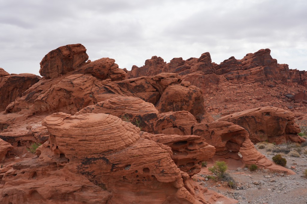
The trip to St. George was not too bad. I split the trip into two overnights so I did not have to drive too far each day, stopping in Bakersfield CA, then on to Las Vegas, which would get me into St. George for check-in way ahead of schedule. I like having extra time – no pressure. I’ve done the trip to Las Vegas (and St. George) many times with my wife – that was the southern route to/from Sacramento and Denver, and we once did a trip from Denver to LA to visit family through those cities. This time around, I stayed at the same hotel in Las Vegas, away from the strip – never been into the casinos. I did slip one side-trip into the schedule – Fire Valley State Park, on the way to St. George. This is one of Nevada’s premier state parks. It’s sort of like Red Rocks (CO) or Roxborough (also CO) parks on steroids. You can just drive around the loop roads to see the sights, or stop and hike on some really nice trails. Incredible red rock formations and scenery, plus the geology is interesting as well


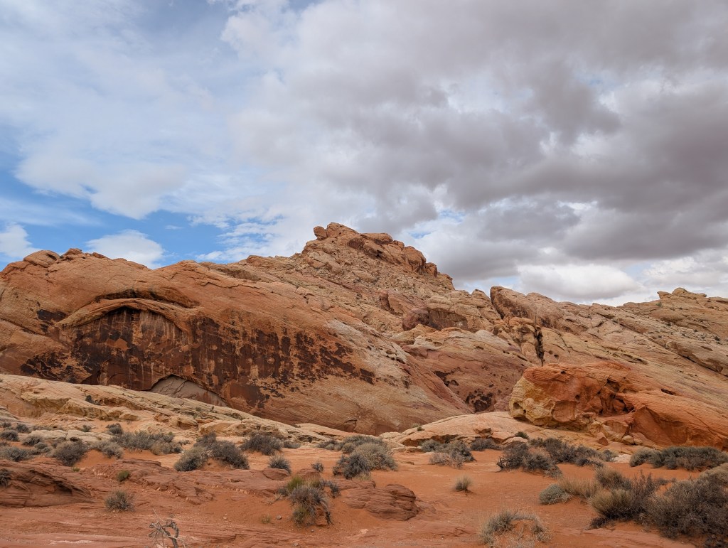
The weather was pretty crappy – drizzling, windy and cool, so the photography was not great, but it was a good start to the trip, and I planned to hit this on my the return trip. The park closes all the trails on May 15th for the duration of the summer. It gets way too hot for hiking. You can still drive through it though.
I pulled into St. George in the afternoon, and checked in with Road Scholars team. The tour lead was an extremely interesting local (from St. George) – very personable, and he turned out to be a perfect fit for this trip. He was a Swiss Army knife of a tour guide – he knew just about everything about this particular part of Utah – a fountain of information on geology, hiking, flora/fauna and history, and was an excellent organizer as well. That evening, we had a group dinner, and then had a Geology 101 lesson from a local expert from Utah State (I think). That was fun for me…sort of a refresher. We also got a really cool book on the geology of the parks in Utah. Bonus round!
The group was very small – 13 of us total. There were two couples, 8 women, and me. Most everyone was from the East coast. I was the only person who drove. Good group – very friendly, and I did not feel weird being the only single guy. Same thing happened on my last National Geographic trip – the only single out of 85 others. Talk about standing out in a crowd.
Since the Road Scholars trip covered three separate parks, I’ll break the rest of this post up into sub sections.
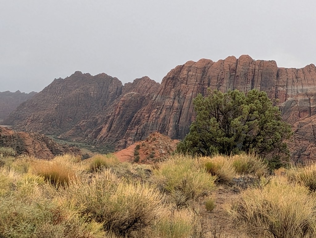
Snow Canyon State Park
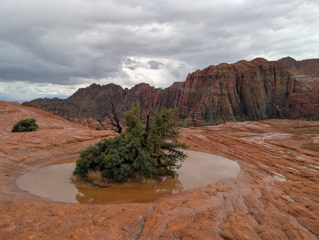
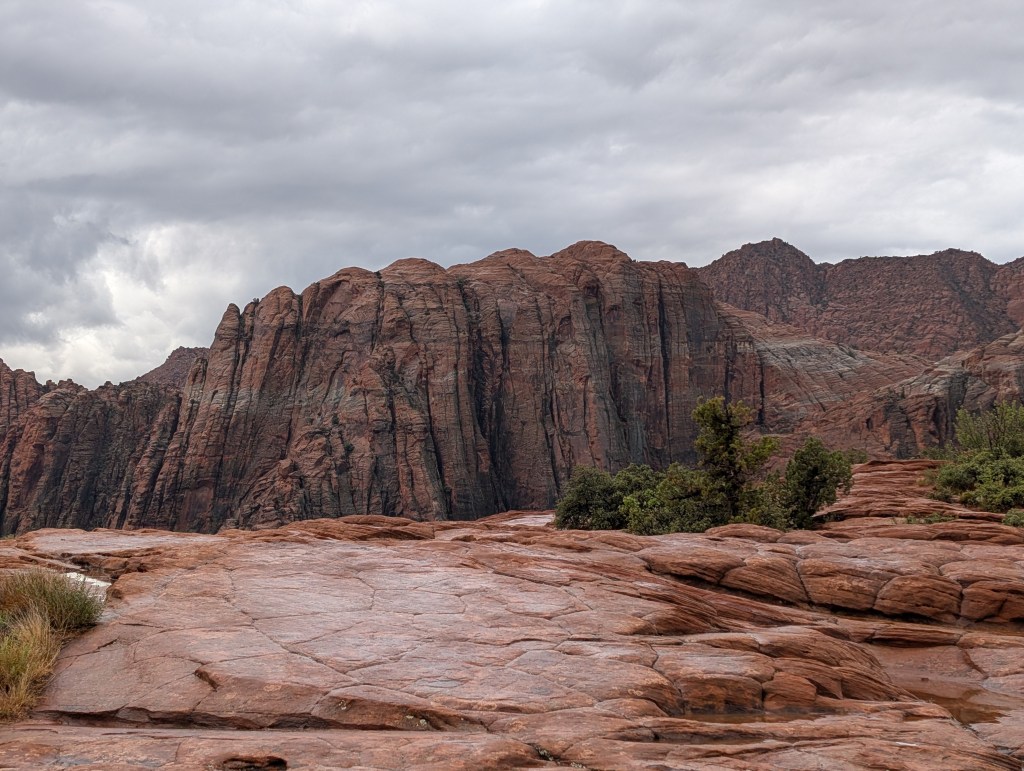
This park is located just west of St. George, and is a popular hiking spot for residents in the area. It has sweeping vistas of the huge wall of Navajo sandstone which borders the west side of St. George, and has a lot of interesting hikes which wander through the sandstone and lava formations. There are even a few lava tubes – long caves, which run through portions of the park. A lot of different things for hikers and geologists. The park also has some movie history as well. A number of scenes from Butch Cassidy and the Sundance Kid were filmed in the park. Some visitors try to find all the locations from the film for selfies of course. The pond photo at the head of this post, is a well photographed scene from the movie, where Robert Redford was kneeling for some reason. I think Paul Newman was filmed floating in the water as well. Whatever.
For our hike, there was plenty of water ponding on the sandstone, since it rained (poured) for the duration of this hike. Made for some tricky footing….more like mud in some places. The sandstone was rough enough to provide stable footing, but the sections with lava rock were tricky. There were also a few steep sections as we wandered around for 5 miles in the rain. I’d love to go back there when the sun was shining. It’s really a gem of a park. St. George is also a nice city.


There was so much rain that day that there were waterfalls cascading down the cliffs, something you don’t see to often in that part of Utah. The bad news is my new REI raincoat was not really cut out for heavy rain. I was really wet and chilled when we finally got back to the bus. Fortunately everything dried out quickly – even my boots (after using the hairdryer on them). I’m glad we were staying in hotels instead of camping.
One thing I did learn about this tour from the first day – this was a hiking trip, while I was interested in a hiking AND photography trip. I had a brand new Sony A7IV, which I purchased a few days before the trip. Another tariff avoidance purchase. I really wanted to test it out on landscape photography, and had brought only two lenses along, a 17-28 wide angle, and a 28-105 telephoto. I was not planing on wildlife photography unless the subject was really close. So, as it turns out, I was the only person on this trip that had a camera that was not also a phone (I had my Pixel phone too). This was not like the National Geographic trip, where photography took precedence over most everything else. The problem for me was that everyone just charged ahead, listening to the trip lead who had a microphone/radio setup so everyone could hear him as we wandered along. It was easy enough for everyone else to just pull there phones out to snap a photo. I learned quickly how to solve the problem – I just stayed back to get the shots I needed, and caught up to the group. The trip lead was super flexible, and wanted to make sure everyone was getting what they wanted out of the trip. I was never left behind, nor did I slow down the group. A good thing of course.
Zion National Park
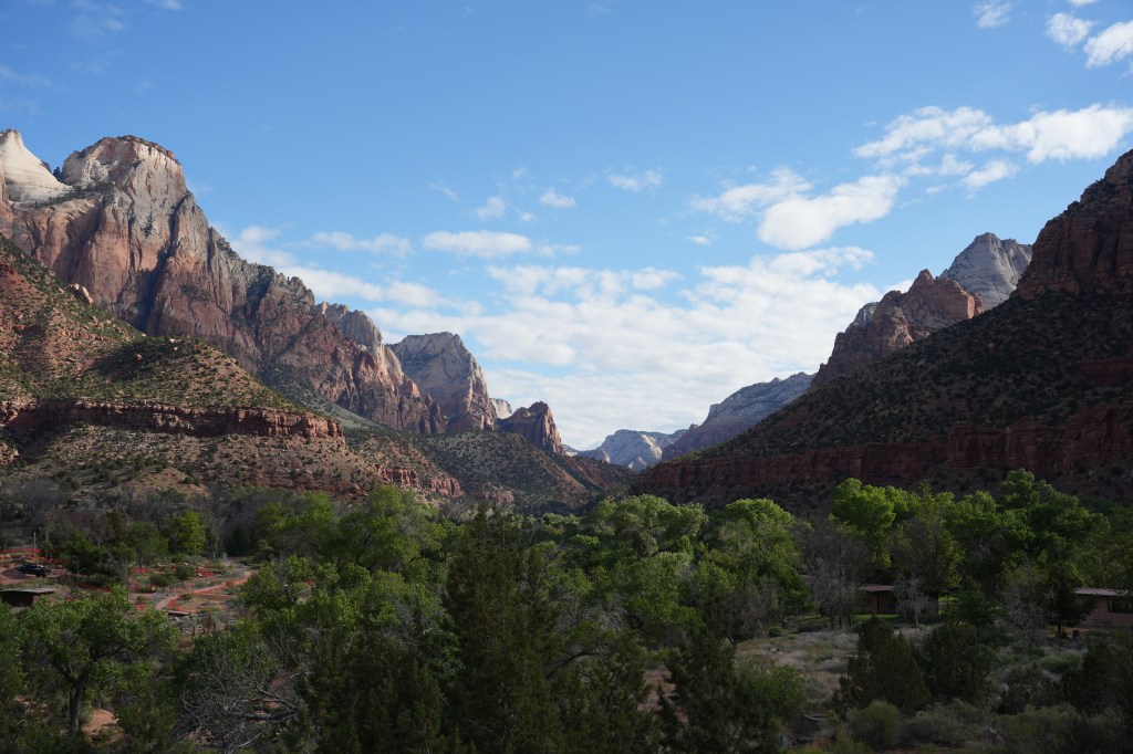
Zion has been on my punch list for a very long time, and it did not disappoint. The trip to the park from St. George was interesting, especially with our tour guide supreme who pointed out all the geologic features we were passing, as well as interesting historical facts about some of the towns, like Hurricane. Once we pulled into the park, we immediately set out on a warm-up hike – only 700 feet elevation gain (seemed like more) with a few switch backs, to a great overlook point. Here’s where I decided to start hanging back to take photo’s (the bus driver/lead kept looking back to make sure I was following). Incredible views of the towering rock walls and peaks from that point.


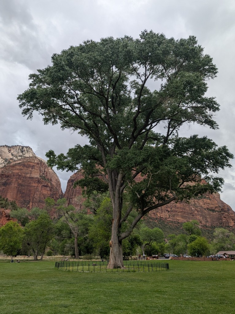
We bussed from there to the Zion Park lodge, another absolutely beautiful spot with views of the cliffs, lots of nice places to sit, and a large open area with a gigantic cottonwood tree in the center. All they need there is a Starbucks or Dairy Queen. Lunches were all boxed for us, with large sandwiches, sides, fruit and some sort of cookie. This day, we each had a container with about 2 pounds of potato salad, enough for a family. After lunch, we headed off to our next hike – a relatively “easy” hike that most every tourist goes on, to the Emerald Pools.
The trail to the pools is a series of ups and downs with a lot of steep rock steps and narrow passages – perfect for handling large crowds (not really). There were choke points all along the trail and unfortunately, the rock steps were the final straw for my knee, which finally said it had enough for the day. Fortunately, all we had left at that point was one steep set of rock steps, followed by a real, paved path which led back down to the river. We all opted to get our feet/shoes wet, since we could simply cross the narrow (cold) Virgin River, and be right back at the lodge. The alternative was to go back the way we came….through all the crowds. Nobody fell in the stream, and it was nice just hanging around, waiting for the bus to take us to our hotel for the night. I really could have used a grande frappacino. Darn. That evening is when I really started to appreciate hotels that had hot tubs. Fortunatly, ever place we stayed had one. Ahhhh.

That evening, after dinner, we had another of the Road Scholars educational experiences – the head of a birds of prey rescue organization gave a lecture, and brought a few of his feathered friends along. The lecture was great, and seeing the magnificent birds (Screech Owl, 2 falcons, a hawk, and a Golden Eagle) was amazing. We have Screech Owls in the woods behind my house – we hear their warbled calls (not a screech) but have never seen one. I surprised how tiny they are…cute little things.


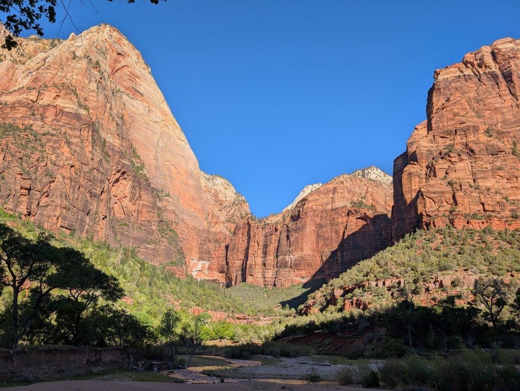
The next day, our trip lead gave us choices for the morning hike. The more difficult one climbed up to an overlook called the Boy Scout Lookout, which required hiking up two long stretches of steep switchbacks (including Walter’s Wiggles). This is the trail that leads to the start of Angels Landing trail, which requires a permit and probably a waiver, since it is very steep and exposed. Sort of like the Yosemite Half Dome cable route, but with a chain to hang on to. The optional hike, was to follow the Virgin River for 7 miles, getting some great views of the valley and rock walls, until you reach the narrow end of the valley. My brain wanted to do the hard hike, but my knee won out and I opted for the less strenuous hike. That worked out – we had the morning light, and I was able to shoot a lot of photos, at my own pace. There was no real trail – we bushwacked a lot, and followed what was probably a deer trail at times.


The final hike at Zion was to wade into the Virgin River in the narrows – this is a significant tourist trap, where the outfitters in Springdale rent out entire outfits (boots, waders, staffs) so you can avoid getting wet. The place at the end of the paved trail where you enter the river looked like a wading pool at a water park – way too crowded. I passed on the opportunity, but walked the trail anyway, just to see what it looked like. There were people pushing baby carriages, and even a few folks on walkers. Not a difficult hike.
I managed to walk/hike about 7 miles that day. More than enough. Most of it was relatively flat – my knees were grateful.
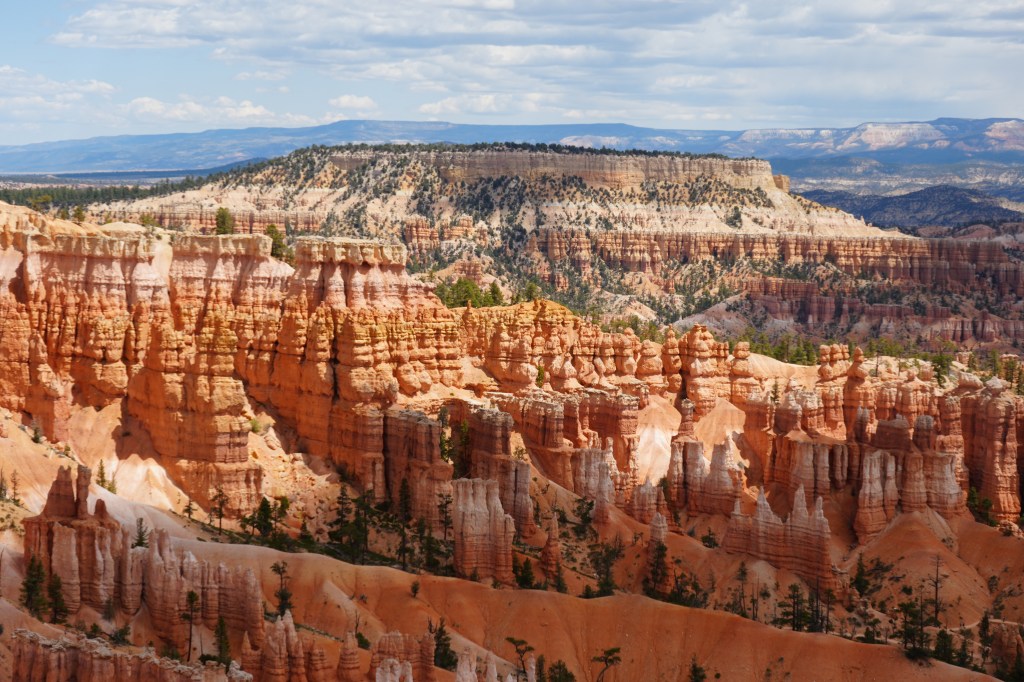
Bryce Canyon National Park
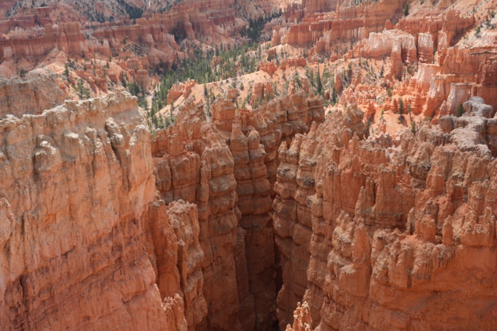
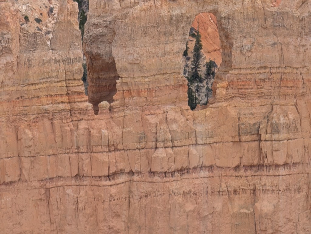
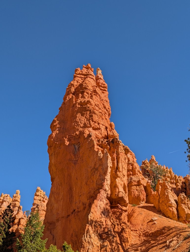
The next morning we loaded up our luxury bus once more, and headed off to Bryce Canyon. That was a beautiful drive, and included going through the Mount Carmel Tunnel….not to be missed. Once we reached the park, we first stopped at one of the park overlooks – OMG. I have seen photos of Bryce before, but these could not come close to seeing the expanse of this amazing place in person. What makes Bryce so special, is erosion. Over time, the sandstone erodes along fracture lines into thin “fins”, with slot canyons separating the fins. Freeze/thaw cycles create windows within the fin walls, which continue to erode, creating very strange narrow towers, called ‘hoodoos’. These take on strange shapes as the softer rocks erode faster than the hard capstone sandstone at the top layer. And there are different colors too, as the sandstone continues to leach out. The park is basically a huge basin with slot canyons and all kinds of strange hoodoos. There are trails along the rim, with viewpoints that can be reached by auto, and trails which head down to the canyon floor and meander through the fins and hoodoos. The place is magical…I’ve never seen anything quite like it.


The first hike that day pretty much stayed on the rim – I forget how many miles it was, since I was focused on taking photographs and just enjoying the incredible view. I think I was giggling as I was walking along. After lunch, we did another hike – I opted out on the longer hike, and went off with one other person to view one of the named hoodoos, Thor’s Hammer. We dropped down into the canyon part way to see it.

The next day was our last hike before heading back to St. George. I went with a small group to follow the Wallstreet trail down to the canyon floor, and then back up after viewing a few more of the named hoodoos. The trail down was fun, heading into a slot canyon between the rock fins. It was a pleasant walk through the canyon, and a long climb back out. Well worth it.


Bryce was, to me at least, the highlight of this trip and someplace I want to return to.
We motored on back to St. George that afternoon, staying at the same hotel we started out in (good thing since my car was there). We had a nice farewell dinner, and said our goodbyes that night. I really enjoyed this trip – it was nice having a smaller group for a change. It’s hard to get to meet everyone on a cruise with 80-100 passengers on the National Geographic tours. It was also nice to have a place to share photo’s, but as with all the trips, interest fades once the trip is over.
But, at least I had more to look forward to. On to Kanab. And the next Post
